


32 GPSMAP 182/182C Owner’s Manual
MAIN PAGES > MAP PAGE
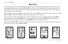
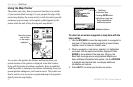
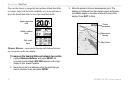
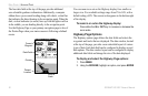
You can also choose to merge the four medium default data fields
to a single, large field for better readability or you can split any or
all of the default data fields to show four small data fields.
Single, large data
field
Default, medium
fields
Split, small
fields
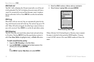
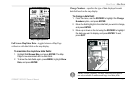
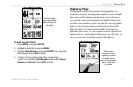
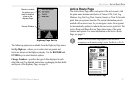
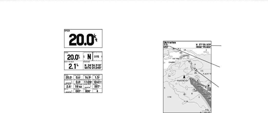
Measure Distance—measures the bearing and distance between
any two points on the map display.
To measure the bearing/distance between two points:
1. Highlight Measure Distance, and press ENTER. An
on-screen pointer labeled ENT REF appears on the map
display at your present location.
2. Move the pointer to a reference point (the point that you
want to measure from), and press ENTER.
3. Move the pointer to the end measurement point. The
bearing and distance from the reference point and pointer
coordinates appear in the data window at the top of the
display. Press QUIT to finish.
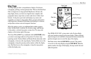
Distance and
Bearing
Map Pointer
Full screen map shown.
Pointer
Coordinates