Map Page
The GPS 125 Sounder features a real-time moving
map that can do much more than just plot your course
and route. The Map Page also provides you with a tar-
get cursor that will let you pan ahead to nearby way-
points, determine the distance and bearing to any map
position, and mark new waypoints while you navigate.
The map contains 12 selectable range scales from
0.2 to 320 miles (0.5 to 600 km). The scale represents
the distance shown from the top of the screen to the
bottom. Move from scale to scale by using the dedicat-
ed zoom keys (IN and OUT). Press IN for a smaller
scale map and press OUT for a larger scale map.
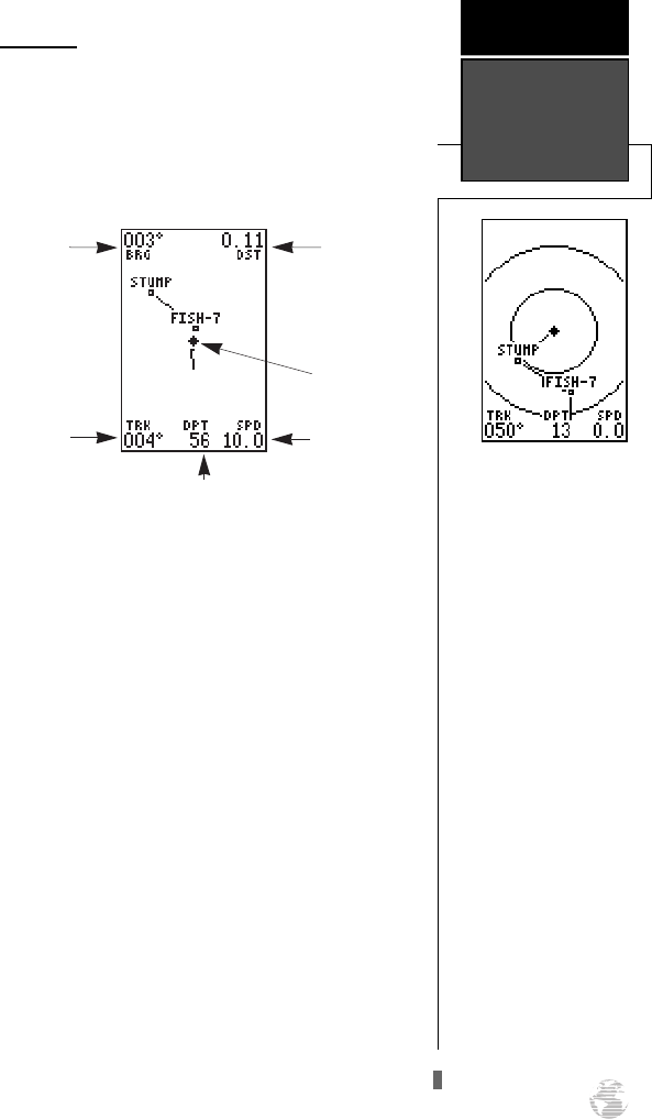
A diamond icon in the center of the page represents
your present position, with your track and/or route dis-
played as a solid line. Nearby waypoints are shown as
squares, with the corresponding name listed. You may
select which items are shown through the map setup
submenu page (see pg. 56 for more information).
The four corners of the Map Page are used to dis-
play various navigation data, including the bearing and
distance to a destination waypoint and your current
track and speed over the ground. The two fields at the
top corners of the map show your bearing and distance
to one of three selectable destinations: an active desti-
nation waypoint; a highlighted on-screen waypoint; or
the panning target crosshair. If you are not navigating
to a waypoint or using the panning function, the top
data fields will not be displayed. The bottom corners of
the display always show your current track and speed,
with the digital depth shown in the center.
41
The GPS 125 Sounder has
on-screen range rings to
help you estimate distances
relative to your present
position. The value of each
ring is determined by the
current zoom scale, and is
equal to 1/5 of the selected
scale.
To turn the range rings dis-
play on or off (the default
setting is OFF) see the map
setup instructions on pg. 55-
56.
REFERENCE
Map Page
Bearing to
Waypoint
Track Over
Ground
Speed Over
Ground
Distance to
Waypoint
Present
Position
Digital Depth
125 Man Rev B 7/23/98 11:48 AM Page 41


