40
➲ Tracking display shows about 125mile (200km) tracking of your car with a white dots.
When your car speed is under 3mile/h (5km/h), the dots are red. When your car speed is
more than 3mile/h (5km/h), but less than 12mile/h (20km/h), tracking shows in orange dots.
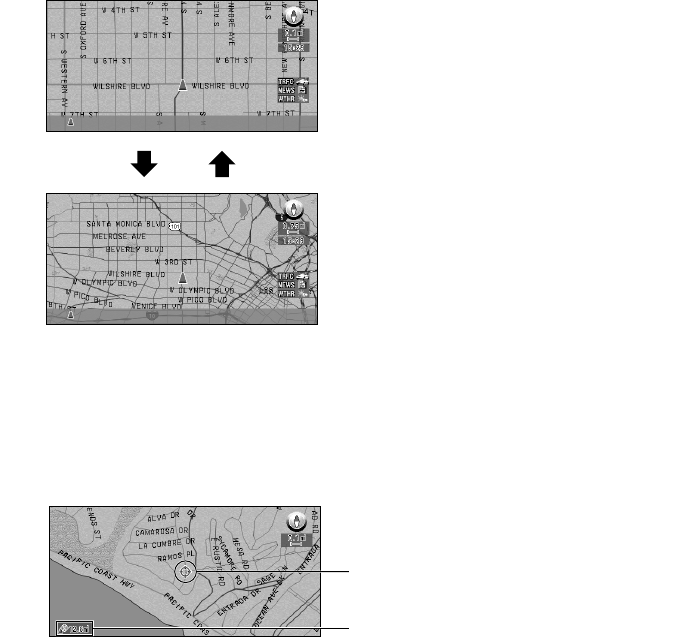
■Changing the scale of the map
On the top-right of the map display, the scale of the map is shown. If you move the scale con-
trol up or down, you can change the scale of the map through 16 levels:
25yd, 50yd, 100yd, 0.25mi, 0.5mi, 0.75mi, 1mi, 2.5mi, 5mi, 10mi, 25mi, 50mi, 100mi,
250mi, 500mi, 1000mi (25m, 50m, 100m, 200m, 500m, 1km, 2km, 5km, 10km, 20km,
50km, 100km, 200km, 500km, 1000km, 2000km). If you keep holding up or down the scale
control, you can zoom in or out in smaller increments.
■Moving the map to the location you want to see
You can move the joystick of the Remote Control up and down, left and right, or diagonally.
If you move the joystick towards the location you want to see, the map moves accordingly. If
you press down the joystick while moving the map, you can move the map more quickly. At
this time, the cross pointer appears at the center of the screen. Also a line connecting between
the current location and cross pointer appears.
(1) Scroll location
The position of cross pointer shows the location selected on the current map.
(2) Distance from the current location
The distance in a straight line between the location pointed by cross pointer and the current
location is shown.
When you want to see smaller streets with a more
detailed map
When you want to know a rough position, or seeing
wider range
(1)
(2)


