


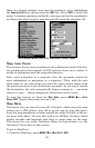


92
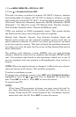
By default, many receivers show the map with north always at the top
of the screen. This is the way most maps and charts are printed on pa-
per. This is fine if you're always traveling due north. What you see to
your left corresponds to the left side of the map, to your right is shown
on the right side of the map, and so on. However, if you travel any other
direction, the map doesn't line up with your view of the world.
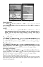
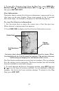
To correct this problem, AirMap defaults to a track-up mode that ro-
tates the map as you turn. Thus, what you see on the left side of the
screen should always be to your left, and so on. Another option is
course-up mode, which keeps the map at the same orientation as the
initial bearing to the waypoint. When either the track-up or course-up
mode is on, an "N" shows on the map screen to help you see which di-
rection is north .
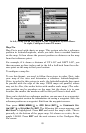
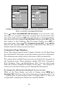
Navionics
Charts
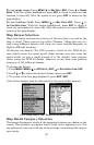
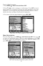
Your unit can display Navionics
electronic charts on MMCs. Both the
GOLD and CLASSIC format charts are accepted. They work just
like a MapCreate custom map on an MMC.
WARNING:
You should never format the MMC containing your
Navionics chart. Formatting the MMC will permanently
erase the chart from the card.
To display a Navionics chart:
1. Install the Navionics MMC in the memory card compartment and
turn on the unit. (For full card install instructions, see Sec. 2.)
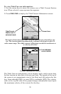
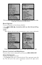
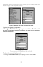
2. From the Map Page, press
MENU|↓ to MAP DATA|ENT|↓ to NAVIONICS
MAP CHOICE|ENT. Use ↑ or ↓ to select the Map Name, then press
ENT|EXIT|EXIT.
These figures show menu sequence (from left to right) for selecting a
Navionics chart for the South Chesapeake area.