


74
sor and let the map return to the current or last known position. (Be-
fore you completely exited out of the Search menus, you could have
gone looking for another place.)
Switch to Aviation Mode
To leave Land Mode and switch to Aviation Mode:
1. Press
MENU|MENU|↓ to SYSTEM SETUP|↓ to ENABLE AIRMAP|ENT.
2. Unit asks, "Are you sure you want to turn on aviation mode?"
3. Press ←|
ENT and the unit switches to Aviation Mode.
Switch Back to Land Mode from Aviation Mode
To leave Aviation Mode and switch back to Land Mode:
1. Press
MENU|MENU|↓ to SYSTEM SETUP|↓ to DISABLE AIRMAP|ENT.
2. Unit asks, "Are you sure you want to turn on land navigation mode?"
3. Press ←|
ENT and the unit switches to Land Mode.
NOTE:
In Aviation Mode, trail displays are turned off by default, but trails
may still be recording. When you switch the unit back to Land
Mode, any trails you've recorded will again be displayed. If these
trails cause too much clutter on the map display, you can hide them
(using the Map Categories Shown option) or delete any unnecessary
trails (as described in the following segment).
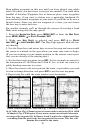
Trails
A trail, or plot trail, is a string of position points plotted by AirMap as
you travel. It's a travel history, a record of the path you have taken.
Trails are useful for repeating a journey along the same track. They are
particularly handy when you are trying to retrace your trip and go back
the way you came.
AirMap lets you save up to 10 trails in its memory. Since you can copy
these trails to MMCs in the form of GPS Data Files (*.usr format), the
only true limit on the number of trails you can record is the number of
MMCs you can carry in your pockets.
(For various trail options, see the Trail Options entry in Sec. 5.)
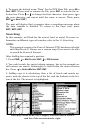
Create and Save a Trail
AirMap is set at the factory to automatically create and record a trail
while the unit is turned on. It will continue recording the trail until the
length reaches the maximum trail point setting (default is 2,000, but
the unit can record trails 9,999 points long). When the point limit is
reached, AirMap begins recording the trail over itself.