


32
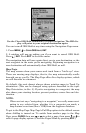
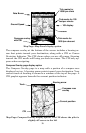
Map Page Menu.
Map Page Menu
To get to Map Page Menu: press
MENU while displaying a map page.
The map menu has many options. It allows you to get information on
the airspace you're in with the Airspace Status command. You can also
find distances, change the orientation of your map, view map data, and
other helpful map functions. Read more about these functions in Sec. 5,
System Setup and GPS Setup Options.
Tip:
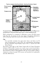
We've incorporated some type of map display in several different
pages. Most of the screen characteristics described in this segment
apply to virtually every map display in the unit.
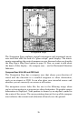
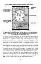
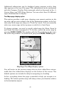
Map Display Options
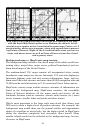
Full Map page display option
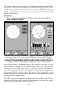
The aircraft symbol centered in the lower third of the screen is your
present position. It points in the direction you're traveling. The default
setting is off, but you can display a solid line extending from the plane's
tail to mark your plot trail, or path you've taken. (Remember, a flashing
question mark on your plane symbol or flashing text displays means
AirMap has not yet calculated a position.)
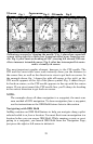
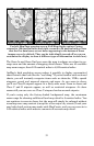
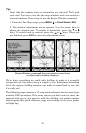
The map zoom range is the distance across the screen. This number
shows in the lower left corner of the screen. In the first example below
left, the range is 4,000 nautical miles from the left edge of the map to
the right edge of the map. In the right image, the range is 30 nm.