


34
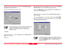
Getting Started with Format Manager-1.1.0enQuick Tour III - Creating a Leica GSI16 Output - Free Codes
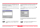
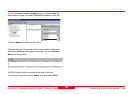
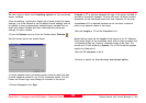
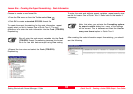
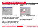
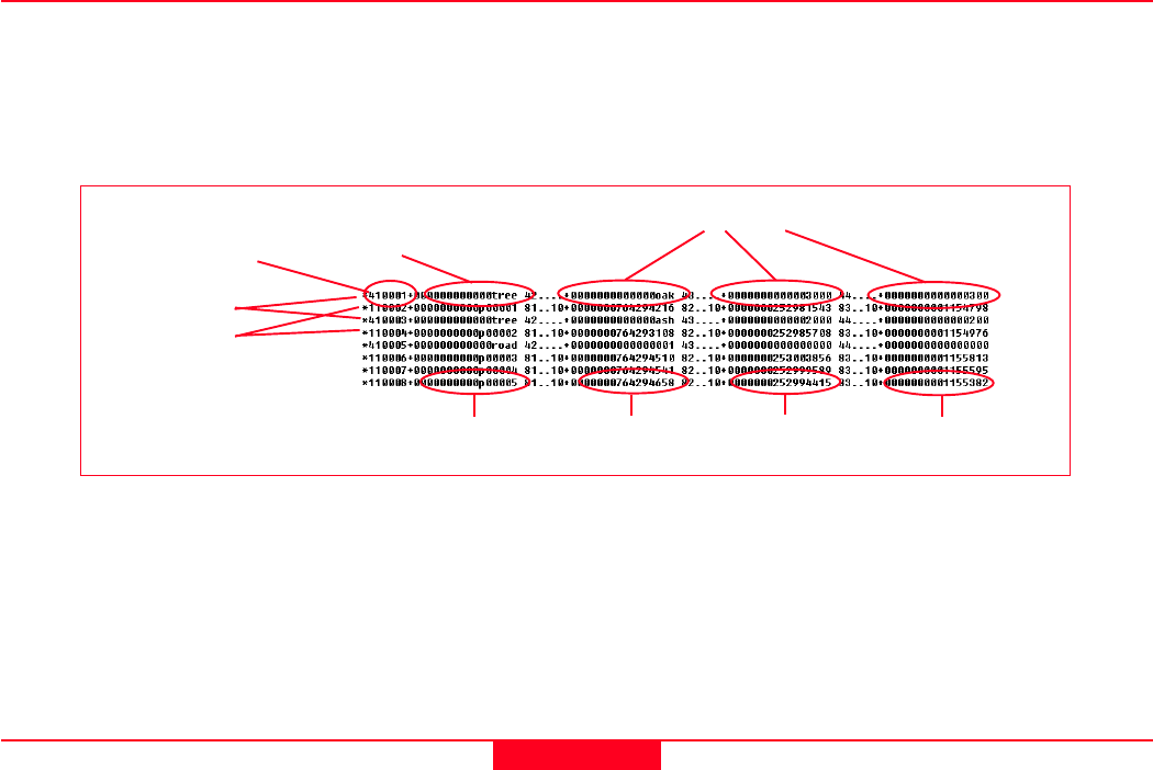
The output shown below is required.
Note here that the code road was only entered once, immediately
before point p00003 was surveyed. Most CAD pakages will
interperate that subsequent points (p00004 to p00005) will also use
this code until a new code is entered. This is the correct way to
survey with free codes.
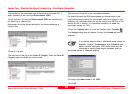
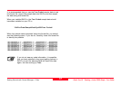
The characteristics of this format file are identical to the format file
created in Quick Tour II:
This format file does not include a Header, Block Titles or a
Footer. It contains only two Export Formatstrings.
The Coordinate values are output in mm values and contain no
decimal point.
All variables are right aligned.
The length of the output variables must always be exactly 16. If the
surveyed data contains less than 16 characters for any variable then
the "fill" character must be 0. If the surveyed data that is output using
this format file contains more than 16 characters, then the data must
be truncated.
Attributes 2 and 3 for the code road were not given a value when
surveyed. In the output above, they are given a "default value" of 0.
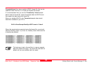
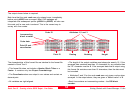
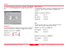
Each line contains an incrementing number - the GSI block
number
Code ID Attributes 1,2 and 3
Point ID Easting Northing Height
Point ID and
coordinates
Code data
Incrementing
block number