


vi
Introduction
Features and Capabilities
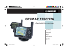
Designed for detailed electronic charting capability, the GARMIN GPSMAP 176 is a powerful device
that can give you the navigation information you need:
Precision Performance
• The GPSMAP 176 features a 3.8” diagonal, high-contrast, 320 x 240 FSTN display with
backlighting
• The GPSMAP 176C features a 3.8” diagonal, 16 color, 320 x 240 TFT display with backlighting
• 12-channel parallel receiver tracks and uses up to 12 satellites for fast, accurate positioning
• DGPS, USCG and WAAS capable
• Fully gasketed, high-impact plastic alloy case, waterproof to IEC 529-IPX-7
Advanced Navigating and Plotting
• 3000 alphanumeric waypoints with selectable icons and comments
• Built-in Americas basemap includes detailed ocean, river and lake coastlines, tide stations, cities,
interstates, US state highways, and local thoroughfares
• 50 reversible routes with up to 50 waypoints each
• Enhanced mapping available by using GARMIN’s BlueChart™ preprogrammed data cards, or
by creating additional data cards using MapSource™ BlueChart or MetroGuide™ U.S.A. PC
products
• Coordinates: Lat/Lon, UTM/UPS, Loran TD, plus 24 grids, including Maidenhead
• TracBack route feature which allows you to quickly retrace your track log to a starting position
• Built-in simulator mode
190-00185-10_0A.indd vi 6/18/2002, 10:00:13 AM