


41
Reference
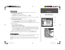
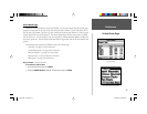
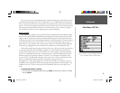
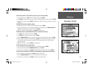
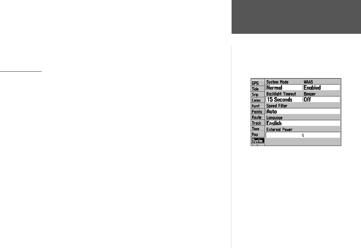
Main Menu: GPS Tab
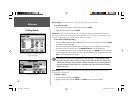
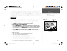
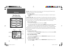
From the Main Menu ‘Systm’ tab, highlight the WAAS fi eld
and press ENTER to ‘Enable’ or ‘Disable’ WAAS.
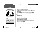
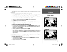
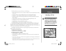
You can use the sky view to help determine if any satellites are being blocked, and whether you have
a current position fi x (indicated by a ‘2D’, ‘2D Differential’, ‘3D’, or ‘3D Differential’ in the status fi eld).
The sky view shows a bird’s-eye view of the position of each satellite relative to the receiver’s last known
position. The outer circle represents the horizon (north up), the inner circle 45º above the horizon, and
the center point a position directly overhead. You can also set the sky view to a ‘Track Up’ confi gura-
tion, causing the top of the sky view to align along your current track heading.
WAAS Capability
The GPSMAP 176 is capable of receiving WAAS (Wide Area Augmentation System) satellite signals.
WAAS is an FAA (Federal Aviation Administration) funded project to improve the overall accuracy and
integrity of the GPS signal for aviation use, but land/sea based users may also benefi t from this system.
At this time, the system is still in the development stage and is not fully operational. There are currently
two WAAS satellites that can be received in the U.S.A., one over the Atlantic Ocean and one over the
Pacifi c Ocean, in a geo-stationary orbit over the equator. Effective use of the WAAS satellite signal may
be limited by your geographic location in relation to those satellites, now in developmental service.
WAAS satellite signal reception requires an absolute clear view of the sky and works best when there
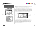
are no nearby obstructions such as buildings, mountains, etc. WAAS satellites will be numbered 33
or higher when viewing the sky view on your GPSMAP 176. Initial reception of the WAAS signal may
take up to 15-20 minutes each day, then 1-2 minutes afterwards. When WAAS differential correction
has been received for GPS satellites (numbers 32 or below), a ‘D’ will appear in the signal bar of the
sky view and ‘2D or 3D Differential’ will appear in the receiver status. To learn more about the WAAS
system, its satellite positions and current state of development, visit the FAA web site:
(http://gps.faa.gov). Since WAAS requires CPU resources of the GPSMAP 176 to search for and track
the satellites, you may disable the WAAS feature to improve unit performance if WAAS reception is not
available in your area. The unit will not search for WAAS satellites if the unit is in the Battery Saver
mode.
To disable/enable WAAS capability:
1. From the ‘Systm’ tab, highlight the WAAS fi eld, press ENTER and select either ‘Enabled’ or ‘Disabled’
and press ENTER.
190-00185-10_0A.indd 41 6/18/2002, 10:00:52 AM