


Reference
10
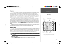
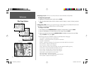
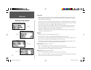
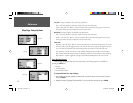
Map Page Setup Options
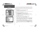
General Tab
Detail— Most, More, Normal, Less, Least: controls how much map detail you will see. This setting
only applies to any map feature set to ‘Auto’. Those features which have a specifi ed scale or turned
‘Off’ are unaffected by this setting.
Orientation— North Up: fi xes the top of the map display to a north heading; Track Up: fi xes the top
of the map display to the current track heading; Course Up: fi xes the map so the direction of naviga-
tion is always “up” and turns the navigation leg line vertical on the screen.
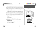
Color Mode— Water Mode or Land Mode: when in ‘Water Mode’, land will appear as a dark color
and water will be light. In ‘Land Mode’, land will appear as a light color and water will be dark. If
using optional BlueChart data, ‘Water Mode’ is recommended.
AutoZoom— On/Off: when ‘On’ the map will automatically adjust the map scale to a lower scale as
you approach you destination point.
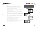
Map Tab
Basemap— On/Off: turns the built in basemap on or off.
Data Card Maps— On/Off: turns all optional BlueChart/MapSource data on or off.
Lat/Lon Grid— Off, Auto, 20 ft.-800 mi: sets the maximum scale at which the feature appears on the
screen. Some types of data will only be displayed to certain zoom scales.
Grid Labels— Off, Auto, 20 ft.-800 mi: sets the maximum scale at which the feature appears on the
screen. Some types of data will only be displayed to certain zoom scales.
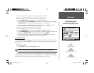
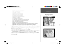
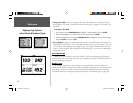
Waypoint Tab— Waypoints, Active Route
Text— Off, Small, Medium, and Large: controls the screen size of the name.
Zoom— Auto, Off, 20 ft.-800 mi.: sets the maximum scale at which the feature appears on the screen.
Some types of data will only be displayed to certain zoom scales.
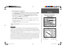
Point Tab
— Businesses, Facilities, Geo/Exit
Text— Off, Small, Medium, and Large: controls the screen size of the name.
Zoom— Auto, Off, 20 ft.-800 mi.: sets the maximum scale at which the feature appears on the screen.
Some types of data will only be displayed to certain zoom scales.
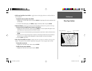
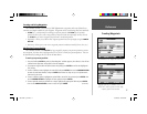
Map Tab
Point Tab
Waypoint Tab
General Tab
190-00185-10_0A.indd 10 6/18/2002, 10:00:19 AM