


3
Map Page
Reference
Map Page
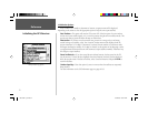
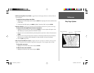
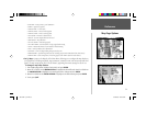
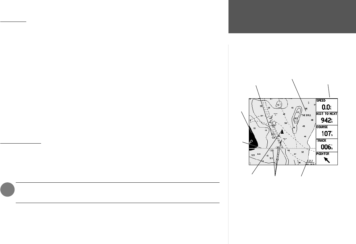
The GPSMAP 176’s Map Page provides a comprehensive display of electronic cartography, plotting
and navigational data. When using the unit with the optional BlueChart data or MapSource soft-
ware, the map display shows your location on a digital chart, complete with geographic names, map
items, navaids and a host of other chart features. It also plots your track and displays any routes and
waypoints you create. An on-screen cursor lets you pan and scroll to other map areas, determine the
distance and bearing to a position, and perform various route and waypoint functions.
Two basic map operating modes, position mode and cursor mode, determine what cartography is
shown on the map display. Position mode pans the cartography to keep the present position marker
within the display area, while cursor mode pans the cartography to keep the cursor within the display
area. The GPSMAP 176 will always power up in the position mode, with the last known location cen-
tered on the map display. When the ARROW KEYPAD is pressed, the GPSMAP 176 will enter cursor
mode.
When the cursor is active, an additional data window will appear at the top of the screen to indicate
the position, range and bearing to the cursor or a selected waypoint or map item.
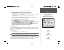
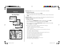
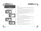
Using the Cursor
The cursor allows you to pan away from your present position and scroll to other map areas around
the world (even outside of your current detail coverage). As you pan past the edge of the current map
display, the screen will actively scroll forward to provide continuous map coverage (keep in mind that
the boat icon will move with the scrolling map, and may not be visible on the display screen).
NOTE: When the cursor reaches the edge of the map, the unit may pause as it loads new
map data.
To move the cursor:
1. Press the ARROW KEYPAD to move the cursor in an up, down, left or right direction.
)
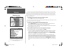
Data Fields
Current
Location
Map Scale
Land
Water
Geographic Name
Navaids
User
Waypoint
Map Page with optional BlueChart Marine data.
190-00185-10_0A.indd 3 6/18/2002, 10:00:15 AM