


Reference
17
Creating Waypoints
Creating and Using Waypoints
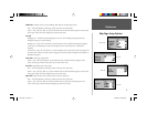
The GARMIN GPSMAP 176 stores up to 3000 alphanumeric waypoints with a user-defi ned icon,
comment, and depth available for each waypoint. Waypoints can be created using three basic methods:
• ENTER key— used primarily for marking your present position, the ENTER key also provides
options that allow you to select a map position or map item from the map display. You may also use
the ENTER key to create a waypoint projected from a user-defi ned position.
• Graphically— allows you to defi ne a new waypoint position from the map display using the ARROW
KEYPAD.
• Text Entry— allows you to enter a new waypoint’s position coordinates manually (from a chart, etc.).
Marking Your Present Position
The GARMIN GPSMAP 176’s ENTER key lets you quickly capture your present position to create a
new waypoint. You must have a valid position (2D or 3D) fi x to mark your present position. This can
be determined by looking at the GPS tab on the Main Menu.
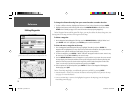
To mark your present position:
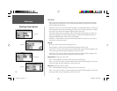
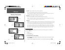
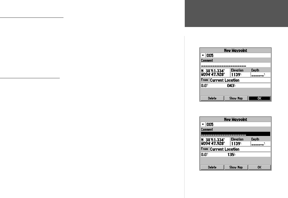
1. Press and hold the ENTER key until the ‘New Waypoint’ window appears, then release it. You will see
a default three-digit name and symbol for the new waypoint.
2. To accept the waypoint with the default name and symbol, press ENTER to confi rm the highlighted
‘OK’ prompt.
3. To enter a different name, highlight the name fi eld and press ENTER, then use the ARROW KEYPAD
to enter the new letter/numbers and press ENTER when done. You may use up to 10 alphanumeric
characters for the name.
4. To enter a different symbol, highlight the symbol fi eld to the left of the name and press ENTER, then
use the ARROW KEYPAD to highlight the new symbol and press ENTER.
5. To enter optional comments, elevation or a depth, highlight the appropriate fi eld and press ENTER,
then use the ARROW KEYPAD to enter a value and press ENTER.
(continued)
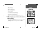
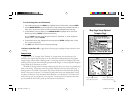
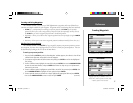
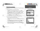
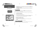
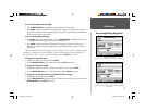
Press ENTER to use the default name and symbol.
Highlight a fi eld and press ENTER to enter a new
symbol, name, comment, position, elevation, depth
or distance from the current location.
190-00185-10_0A.indd 17 6/18/2002, 10:00:23 AM