


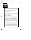
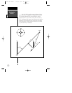
Navigation
Basics
INTRODUCTION
4
NORTH
“ACTIVE FROM”
WAYPOINT
NORTH
DTK
CROSSTRACK ERROR
BRG
TRK
GROUND SPEED
DISTANCE
“ACTIVE TO”
WAYPOINT
“ACTIVE LEG”
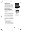
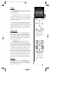
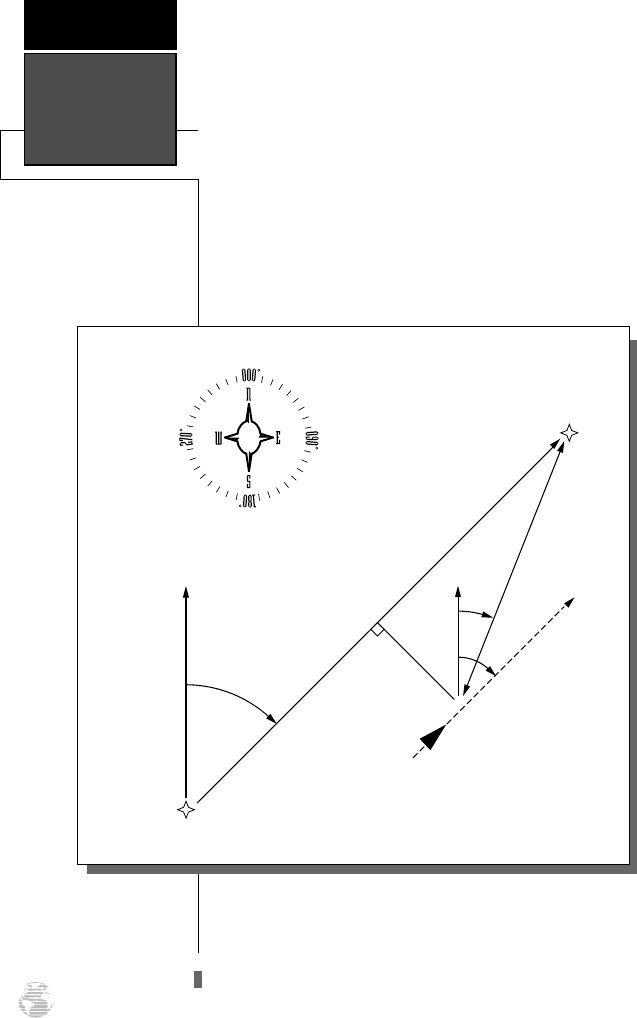
The GPS 120XL provides steering guidance and navi-
gation information using degrees, a measurement measured
in a clockwise direction from a north reference. North is
described as 000º, east as 090º, south as 180º, and west as
270º. The diagram and compass rose below provide a graphic
illustration of the navigation terms used by the GPS 120XL.
More information on basic navigation and GPS are available
at your local library or bookstore.
120XL Man RevB 7/10/98 10:54 AM Page 4