


68
set GPS Switch 51
set the backlighting timeout 51
set the date 56
set the date and time 54
set the location 54, 56
set the month and year 55
set the time 49
show Data Fields 13
show Nav Status 13
stop navigating 13, 18, 40, 46
transfer data 62
use Setup Map options 15
use Sight N Go to navigate 18
use the Measure Distance option 15
use the View Points option 24
use Track Log Setup options 48
view Elevation or Pressure plots 23
view the next waypoint in the route 45
Hunt and Fish........................................... 56
I
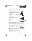
Installing
Batteries 3
Lanyard 2
Interface Page............................................ 52
Internal Antenna ......................................... 2
L
Land Cover ............................................... 14
Land or Water ........................................... 14
Language................................................... 53
LCD Display................................................ 2
Leg Course ................................................ 46
Leg Distance.............................................. 46
Leg Time ................................................... 46
Location (lat/lon)....................................... 60
Location (marking).................................... 30
Location (selected) .................................... 60
Lock on Road............................................ 14
M
Maintenance................................................ v
Main Menu Page.......................................... 4
Main Pages
Altimeter 21
Main Menu 28
Map 9
Navigation 16
Satellite 5
Trip Computer 26
Main Page Basics ......................................... 4
Main Page Menu Button .............................. 4
Maps
Features 14
MapSource™ Map Data CD-ROMs 14, 59,
62
Map Datum............................................... 50
Map Page....................................... 4, 8, 9, 10
Map Page, Main......................................... 60
Map Page options................................ 11–15
Map Scale.............................................. 9, 10
Mark
Options 32
Marking
Location 12
Waypoint 29, 30
Maximum
Ascent 25, 61
Descent 25, 61
Elevation 25, 61
Speed 20
Measure Distance ................................ 11, 15
Memory Used............................................ 53
Minimum Elevation................................... 61
Modes
Demo 53
Normal 53
Moving Avg. Speed.................................... 20
Moving a Waypoint............................. 31, 44
N
National Imagery and Mapping Agency..... 50
Navigation......................................... 4, 8, 17
Data Fields 20
Main Page 16, 60
Options 18
Route 8, 45
Index
190-00219-00_0C.indd 68 9/20/2002, 9:54:53 AM