


6
Satellite
Because the eTrex Vista relies on satellite signals to
provide you with navigational guidance, the unit’s view
of the sky determines how fast you achieve navigational
status. GPS signals do not travel through rocks, buildings,
people, metal, or heavy tree cover so for best results, keep
the unit in clear view of the sky.
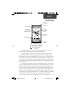
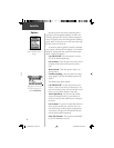
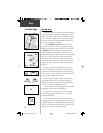
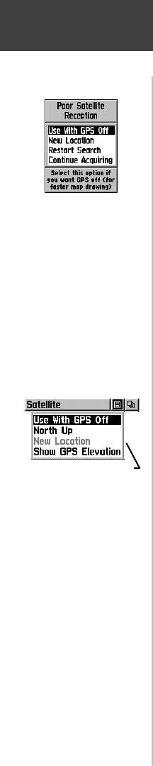
At least three satellite signals are needed to determine
your location, otherwise the unit displays a “Poor Satellite
Reception” message with four options and a brief expla-
nation to guide your decision:
Use with GPS Off - Select this option if you want
GPS off (for faster map drawing).
New Location - Select this option if you have moved
hundreds of miles (from where you last used the
unit).
Restart Search - Select this option if today is not
(date provided).
Continue Acquiring - Select this option if no other
option applies. (The unit will attempt to gather GPS
signals.)
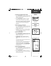
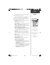
The Satellite Page options include:
Use With GPS Off - Use this option when you are
indoors, a clear view of the sky is obstructed, or you
want to save battery power. You can enter data, create
routes, etc., but cannot navigate in this mode.
Track Up/ North Up - You can orient the satellite
skyview by selecting ‘Track Up’ (your direction of
travel) or ‘North Up’ (the satellite skyview oriented to
the north).
New Location - If you are more than 600 miles from
where you last used the unit, select the ‘New Loca-
tion’ and then the ‘Use Map’ options to approximate
your location. This gives the unit reference informa-
tion and speeds satellite acquisition.
Show GPS Elevation - The elevation as determined
by the GPS information received.
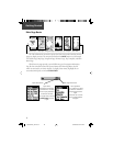
There are four options for
the “Poor Satellite Reception”
message.
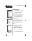
Options
Satellite Page Options Menu
Highlight the on-screen button
at the top of the page & press
in on the CLICK STICK.
190-00219-00_0C.indd 6 9/20/2002, 9:54:18 AM