


9
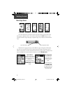
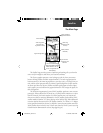
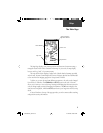
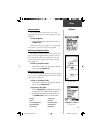
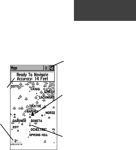
The Map Page displays your present position and direction of movement using a
triangular ‘Position Icon’ that is centered on the map. As you travel, the map display
leaves a track log (“trail”) of your movements.
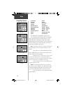
The map shown above displays a higher level of detail than the basemap provided
with the unit, because Garmin MapSource Points of Interest data has been downloaded
to the unit from the mapping program on the optional CD-ROM.
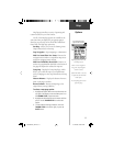
To allow you to view the map from different perspectives, the scale can be changed
from 20 feet to 500 miles. The ZOOM IN and OUT buttons on the side of the unit
allow you to zoom in or out on the map. Pressing and holding these buttons causes the
scale to change rapidly instead of changing in increments. The IN button displays less
area but more map detail, while the OUT button shows you a larger area with less map
detail.
A Status Window at the top of the page provides you with current satellite tracking
and position accuracy information.
Map
Position Icon
Status Window
Map Scale
Map Features
Option and Main
Page Menu Buttons
The Main Page
190-00203-00_0D.indd 9 12/12/2002, 2:58:15 PM