


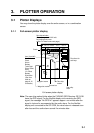
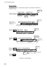
3. PLOTTER OPERATION
3-6
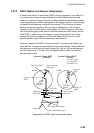
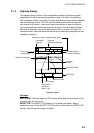
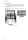
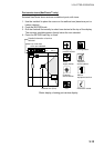
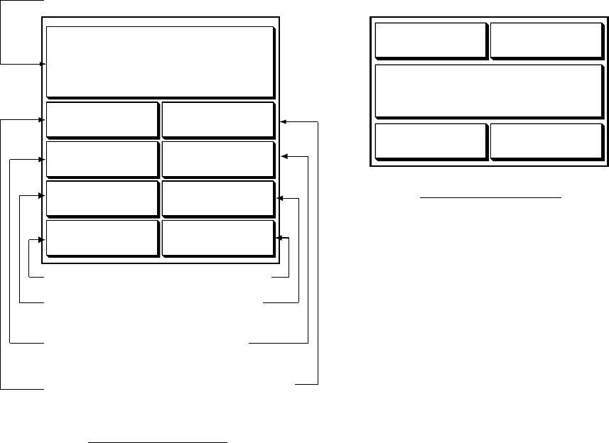
3.1.4 Nav data display
The nav data display provides comprehensive navigation data, and it can be
shown in a full-screen display and a combination display. The user may select
what data to display and where to display it. For details see the paragraph “5.8
Nav Data Display Setup.”
Appropriate sensors are required. Bars ( - -) appear when corresponding sensor
is not connected.
ETA
TTGTRIP LOG
103 nm
TIMEDATE
FEB 1
0D 2H 30M
1st 1:25
01:27:05
2001
POSITION
34° 34. 5678' N
120° 34. 5678'
W
SOGWPT POSITION
COURSESTW
10.0 kt
RANGEBEARING
9.2° M
TEMPDEPTH
Speed over ground
Position
Water temperature
Range to
waypoint
Course
Bearing to
waypoint
Speed through
water
Waypoint
Position
Depth
Half-screen display
Full-screen display
34° 14. 5678' N
120° 14. 5678'
W
10.0 kt
101.6° M
0.18 nm
1324.1 ft
18.2 °C
Nav data displays