


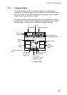
3. PLOTTER OPERATION
3-3
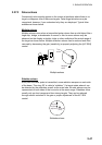
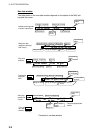
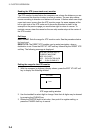
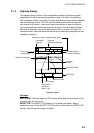
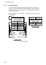
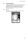
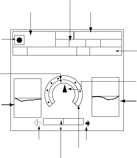
3.1.2 Compass display
The compass display, shown in combination displays, provides steering
information. The compass rose shows two triangles: the solid triangle shows
own ship’s course and the hollow triangle, which moves with course change,
shows the bearing to destination waypoint.
The water temperature and depth graphs, which require appropriate sensors,
show the latest 10 minutes of water temperature and depth data. The range of
the depth graph is 50 feet and it is automatically adjusted with depth.
0
50
20
10
BRG
DPT
TMP
359.9°M
45.2ft
16.2°F
003WPT
0D 9H 59MTTG 23th23:59
ETA
SOG
10.0
kt
10.0
kt
STW
RNG
99.9 nm
359.9°M
N
w
E
Ship's course
Bearing scale
XTE monitor
(Direction off course;
direction to steer)
Depth
graph*
Water
temperature
graph*
TO Waypoint
Time-to-go
to destination
Range to waypoint
Speed
* = Requires appropriate
sensor.
Estimated time of
arrival at destination
CSE
Waypoint
bearing
Direction to steer
Shown when
direction to
steer is "left."
Compass display