


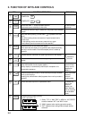
3-6
LYR
3
LYR
2
LYR
1
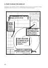
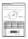
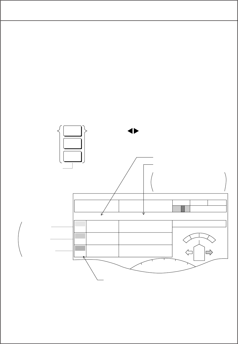
Select layer by key, and turn knob to see desired depth.
Depth value of the
selected layer
appears is green.
Press the same
key again when
desired depth is
set. The depth
value will return to
white.
Layer 1 (Yellow)
Layer 2 (Purple)
Layer 3 (Lightblue)
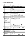
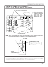
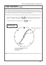
Tide speed in knots.
Tide direction in degree and in
32-point notation.
Locations of degree and 32-point
notation can be swapped.
(See page 5-1.)
Measuring depth of the layer
0
10
20
10
20
3°
0.4
kt
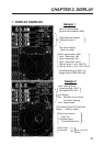
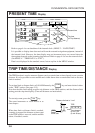
SPEED
12.3
kt
NE
45°
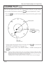
COURSE MODE COMPASS
GT
270.0
17 : 41 : 00
0.8
kt
1.2
kt
0.5
kt
ENE
68
°
N
0
°
NE
45
°
DEP
TIDE
DIRECTION
TRIP
0.00 NM
AVERAGE
N
1
15
2
18
3
30
FUNDAMENTAL DATA SECTION
TIDE SPEED/DIRECTION Display (text)
Tide speeds/directions of three layers are displayed below the ship’s speed/course.
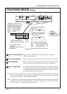
Depending on the tracking mode in use, the meaning of speed/direction changes as follows
` In the ground tracking mode, speed/direction values represent movement of the layer rela-
tive to ground. [Ground-based tide = Absolute tide]
` In the water tracking mode, speed/direction values represent movement of the layer relative
to near-surface water. Strictly speaking, they do not represent tide but tide differential. [Sur-
face-based tide = Relative tide]
` In the nav-aided mode, speed/direction values represent movement of the layer relative to
pseudo ground. [Ground-based tide = Absolute tide]
(Note that accurate ship’s speed/course and heading information must be applied to CI-35/
35H to obtain reliable tide data.)
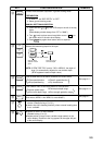
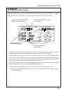
To set measuring depth of tide;
Note: Tide speed/direction display is updated every 3 seconds. The display is not raw data for
every 3 seconds, but averaged for specified averaging time. (See page 4-2 to set averaging
time for tide display.)