


Destinator 6 28
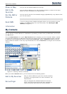
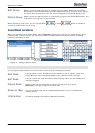
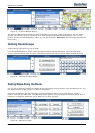
Search for a Location
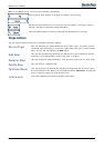
Units of Measure
You can tap the Units of Measure button to specify the measurement system you would
like to use.
You can select:
Miles/Hour
Kilometers/Hour
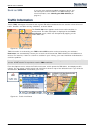
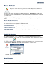
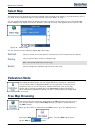
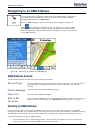
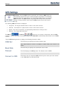
Map Settings
You can tap the Map Settings button to customize your map display, as shown in the
figure below.
The following map settings are:
Map Orientation
Forward is up – This option orients the map so that your forward
direction is always at the top.
North is up – This option orients the map so that North is always at the
top.
Use Automatic Zoom
When this option is selected, the zoom is speed dependent. The map
zooms out at higher speeds, displaying a larger map area, and zooms in
at slower speeds, displaying a smaller map area. If you manually change
the zoom, the Automatic Zoom returns to a system defined zoom level
after several seconds of inactivity.
Use Larger Print
This option increases the size of street names to make the map easier to
read.
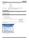
Extras
From the Options menu, tap the Extras button, to display the Destinator add-ons as described in the
sections below.
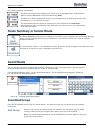
Multistop Planner
The Multistop Planner lets you plan a route with up to twelve stops.
When you tap the GO button, the route is calculated in stages, from the departure point to
the first stop. When you reach the first stop, the route recalculates to the second stop, and
so on.