


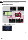
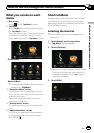
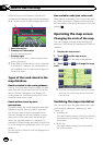
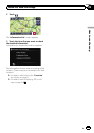
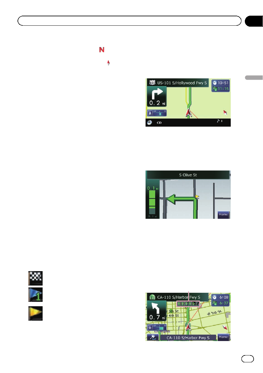
9 Map orientation indicator
! When “North up” is selected, is dis-
played.
! When “Heading up” is selected,
is
displayed.
p The red arrow indicates north.
= For details, refer to Switching the
map orientation on the next page.
a Direction line*
The direction towards your destination (next
waypoint, or cursor) is indicated with a
straight line.
b Current route*
The route currently set is highlighted in color
on the map. If awaypoint is seton the route,
the route after thenext waypoint ishigh-
lighted in another color.
c Multi-Info window
Each touch of [Multi-Info window] changes
the display information.
! Distance to the destination (or dis-
tance to waypoint)*
! Estimated time of arrival at your des-
tination or waypoint*
The estimated time of arrival is an ideal
value calculated based on the value set
for “Speed” and the actual driving
speed. The estimated time of arrival is
only a reference value, and does not
guarantee arrival at that time.
! Travel time to your destination or
waypoint*
d Current time
Meaning of guidance flags
Destination
The checkered flagindicates your
destination.
Waypoint
The blue flagsindicate your way-
points.
Guidance point
The next guidancepoint (next turn-
ing point, etc.)is shown by ayel-
low flag.
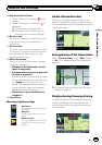
Audio information bar
While the navigation system screen is dis-
played, changing the source or adjusting the
volume displays source information at the bot-
tom of the screen.
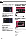
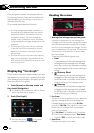
Enlarged map of the intersection
When “Close Up View” in the “Map” screen
is “On”, an enlarged map of the intersection
appears.
= For details, refer to Setting the auto-zoom
display on page 53.
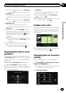
Display during freeway driving
In certain locations of the freeway, lane infor-
mation is available, indicating the recom-
mended lane to be in to easily maneuver the
next guidance.
1
En
17
Chapter
04
How to use the map
How to use the map