


69
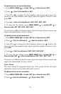
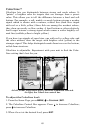
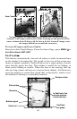
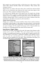
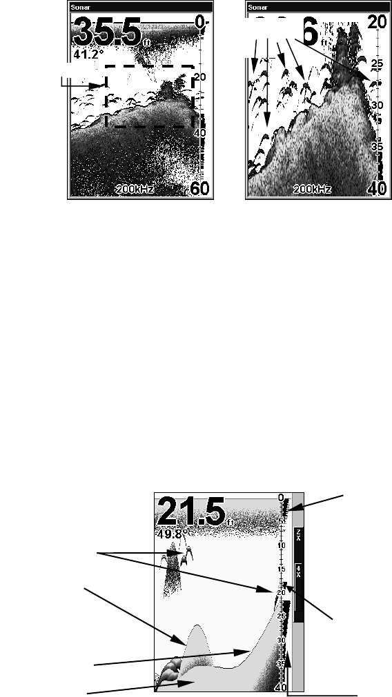
Normal display, in auto depth range mode, left. At right, display
"zoomed" with Upper and Lower Limits focusing on the portion of the
water column from 20 feet to 40 feet deep. In the "zoomed" image, note
the target definition around the structure.
To turn off upper and lower limits:
Reactivate Auto Depth Range. From the Sonar Page, press
MENU|↓ to
AUTO DEPTH RANGE|ENT|EXIT.
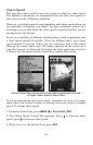
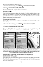
FasTrack
This feature automatically converts all echoes to short horizontal lines
on the display's far right side. The graph on the rest of the screen con-
tinues to operate normally. FasTrack gives you a rapid update of condi-
tions directly under the boat. This makes it useful for ice fishing, or
when you're fishing at anchor. When the boat is not moving, fish sig-
nals are long, drawn out lines on a normal chart display. FasTrack con-
verts the graph to a vertical bar graph that, with practice, makes a use-
ful addition to fishing at a stationary location.
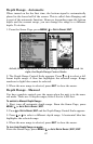
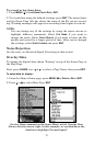
Sonar Page showing FasTrack.
Area "zoomed"
Fish arches
Structure
Bottom signal
Fish arches
In FasTrack, fish
arches show as
horizontal bars.
FasTrack
bar graph
ColorLine
Surface clutter