


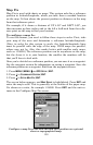
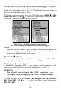
154
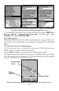
zoom mode on, the unit zooms out until the entire course shows, from
the present position to the destination waypoint. As you travel toward
the destination, the unit automatically begins zooming in — one zoom
range at a time — always keeping the destination on the screen.
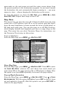
To turn this feature on, from the
MAP PAGE, press MENU|↓ to AUTO
ZOOM|ENT|EXIT. Repeat these steps to turn it off.
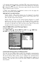
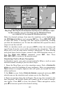
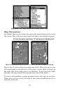
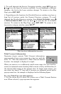
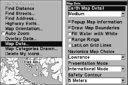
Map Data
This menu lets you turn the map off, if desired (which turns the map
screen into a GPS plotter); turn off or on the pop-up map info boxes;
draw the map boundaries or boxes around the areas of high detail; or
fill land areas with gray. You can also turn on or off Map Overlays,
which display latitude and longitude grid lines or range rings on the
map. This menu lets you select Navionics Maps; for instructions, see
the Navionics Charts entry in this section.
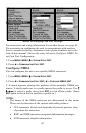
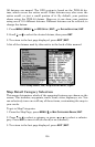
To get to Map Data:
From the Map Page, press
MENU|↓ to MAP DATA|ENT.
Map Menu, left, Map Data Menu, right.
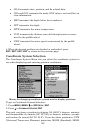
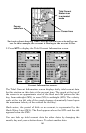
Show Map Data
From the Map Page, press
MENU|↓ to MAP DATA|ENT. Press ENT to enter
the
EARTH MAP DETAIL selection list, and choose how much detail you
want, from Off (so the unit operates like a GPS plotter) to High. After
the option is set, press
EXIT repeatedly to return to the page display.
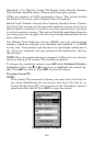
Pop-up Map Information
From the Map Page, press
MENU|↓ to MAP DATA|ENT. Press ↓ to POPUP
MAP INFORMATION. With the option highlighted, press ENT to check it (turn
on) and uncheck it (turn off.) After the option is set, press
EXIT|EXIT to
return to the page display.