


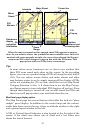
35
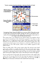
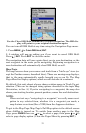
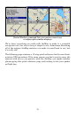
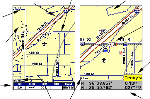
When the map is zoomed out far enough, most POIs appear as square
dots. As you zoom in closer, the symbols become readable icons. In the 0.4
nautical mile zoom example at right, the cursor has selected the Denny's
restaurant POI, which triggers a pop-up box with the POI name. This
pop-up box works on POIs at any zoom range.
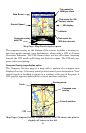
Tip:
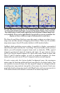
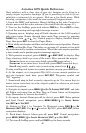
In some urban areas, businesses are so close to one another that
their POI icons crowd each other on the screen. In the preceding
figure, you can see a packed string of POIs all along the west half of
11th. You can reduce screen clutter and make streets and other
map features easier to see by simply turning off the display of POIs
you're not watching for. (To see how, check the text on Map Detail
Category Selection, in Sec. 5. It shows how to use the Map Catego-
ries Drawn menu to turn individual POI displays off and on.) Even
though their display is turned off, you can still search for POIs and
their icons will pop-up when your unit finds them for you.
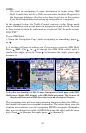
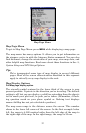
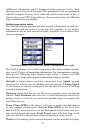
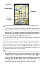
Map Panel page display option
The Map Panel page has several features that offer the look of a “glass
cockpit” panel display. In addition to the central map and the custom-
izable data boxes across the top, it has an altitude window to the right
and a ground speed window to the left.
A VSI or Vertical Speed Indicator is also located at the far right of the
screen. A bar above zero shows rate of climb and a bar below zero
shows the rate of descent.
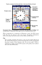
POI
Pop-up
Restaurant
POI
POI
Markers
Position,
distance and
bearing data
Zoom
Range
Interstate
Major Street
Minor
Street
Data boxes
display
navigation
information
Cursor line