


95
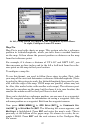
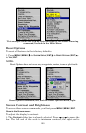
3. To turn off a Navionics chart, from the Map Page, press
MENU|↓ to
MAP DATA|ENT|↓ to NAVIONICS MAP CHOICE|ENT. Use ↑ or ↓ to select NONE,
then press
ENT|EXIT|EXIT.
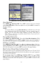
Port Information
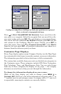
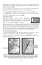
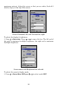
Navionics charts contain Port Services information, represented by an-
chor icons on the map display. These icons appear at the 2 nautical
mile zoom range. An example is displayed in the following figures.
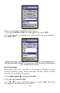
To view Port Services information:
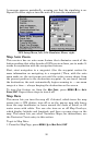
1. Use the arrow keys to move the cursor over a Port Services icon.
When selected, a pop-up name box appears.
2. Press
FIND|FIND to display the Port Services Information screen.
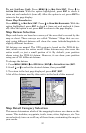
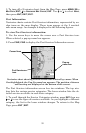
Navionics chart showing Port Services icon selected by cursor. When
first highlighted, the Pop-Up name box appears. The position, distance
and bearing are displayed at the bottom of the screen.
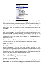
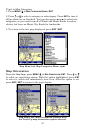
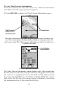
The Port Services information screen has two windows. The top win-
dow lists the various service categories. The lower window lists the de-
tailed services available in each basic category.
3. To scroll through the Service Categories window: press
ENT then use
↑ or ↓ to see the types of services available. As you highlight a different
category, the list in the lower window changes. To return to the Map
Page, press
EXIT|EXIT.
Port Services
icon
Pop-up
name box
Cursor lines