


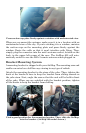


25
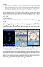
Navigation Page, HSI Map display option.
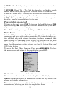
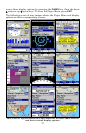
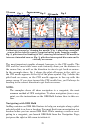
Navigation Display Options
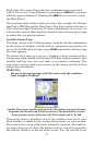
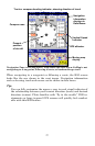
Aviation Map display option
The Aviation Map provides a simplified version of the Map Panel as
described later (under Map Display Options). The Aviation Map, unlike
the general map, shows only Aviation navaids, against a black back-
ground. For more information on the AirMap's moving maps work, read
about the various Map Page displays later in this section.
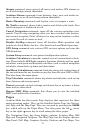
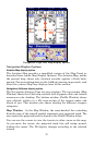
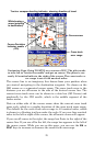
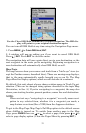
Navigation AirSpace display option
The Navigation Airspace Page has two windows. The top window (Map
Window) shows the relief map overlaid with Jeppesen data and terrain
awareness color shading. The bottom window (Profile Window) shows
your altitude relative to a 2D cross-section of the terrain under and
ahead of you. This window also shows shading for different airspace
categories.
Map Window - In the Map Window, the cross-hatched line extending
from the nose of the aircraft symbol represents your projected track. The
area under this projected track is shown in the Profile Window below.
You can use the cursor to view the terrain in other areas on the map.
As you move the cursor, the projected track line will swing around,
leading the cursor. The 2D display changes according to the selected
terrain.