


Reference
10
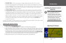
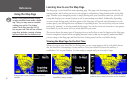
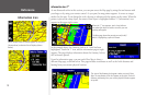
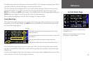
This view of the Gateway Arch appears when you touch Show
Map. The coordinates of the Arch appear at top right. The Arch’s
distance and bearing from your current physical location appear
at top left.
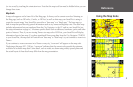
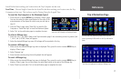
When multiple Points of Interest appear at one point
(shown above) a selection list will display (shown
below).
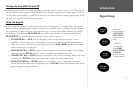
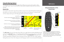
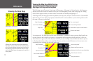
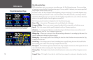
Information Icon
Information Icon “i”
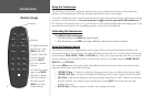
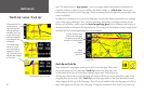
As was discussed earlier in this section, you can pan across the Map page by using the touchscreen with
your finger or by using your remote control. As you pan, the map pointer appears. It serves as a target
marker for the map. If you change the scale, the map is redrawn with the pointer at the center. When the
pointer is placed on a map object, the name of that object is highlighted and an “i” (Information) icon
appears in the upper right corner.
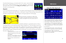
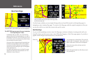
In the example above, the Gateway Arch in St. Louis has been
highlighted. Touch the “i” icon, and the information page at right
appears. The page displays information about the Gateway Arch as
well as feature options.
From the information page, you can touch Show Map to show a
different Map page, as shown below. This page includes coordinates as well as the Arch’s distance and
bearing from your current physical location.
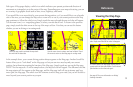
The Map page shows the panning arrow (circled)
which is highlighting a point of interest.
When the “i” icon appears, touch it and informa-
tion about the object or location to which your are
pointing will appear.
information page