


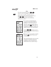

Zooming In
or Out
While using the Panning feature, you can change the
viewing scale of the map
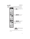
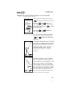
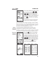
While using the Panning feature press
to display the Pan Zoom options.
Press the or buttons to
select “Quit,” “Zoom,” or “Pan.” With
Zoom highlighted, press to start
the Zoom feature.
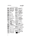
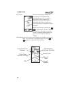
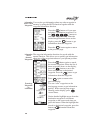
Press the or buttons to
select the Zoom scale.
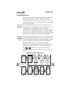
You can also access the Zoom feature
from the moving map by pressing the
or buttons to change the
map scale
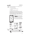
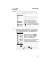
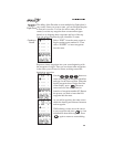
Zooming in changes the view to enlarge
map detail, as if the airplane symbol was
flying at a lower altitude over the map
surface. Zooming in close to airport
waypoints enables you to see your
orientation in relation to available
runways.
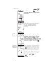
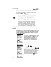
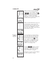
Zooming out allows a view of greater
distance around the airplane symbol, as
if the airplane was flying higher over the
map. As you zoom in or out, the map
scale changes to show the new distance
represented between the airplane symbol
and the top border of the display. When
the scale is large enough, the moving
map shows the political boundaries for
states, provinces, and countries.