


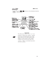
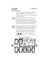
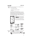
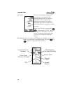
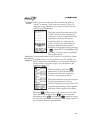

Moving
Map
Screen
The following information shows in highlighted boxes at
each corner of the display:
•
The destination waypoint
•
Bearing to the destination waypoint
•
Map scale
•
Range to the destination waypoint
The moving map screens represent graphic views of your
navigation progress. Your present position is indicated by
the airplane symbol near the center of the display. Note that
the display orientation may be changed so that the top of the
may be North, Desired Track, or Track. The Map Setup
option, described in the Function Reference section, explains
how to change the orientation.
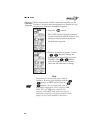
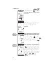
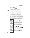
You can change the scale by pressing
the buttons. The scale may
be changed from 0.1 nm to 250 nm or
set to auto for each waypoint type. In
this case, the distance from the airplane
icon to the top of the screen is 40 miles.
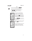
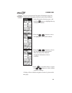
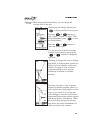
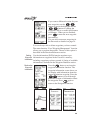
Panning the
Moving
Map
Press the button while viewing the moving map. The
screen displays “PAN” in the upper left corner and the
“airplane” changes to a crosshair. Press the button
again to display Pan and Zoom options. Press the
or buttons to select “Quit,” “Zoom,” or “Pan.” With