


75
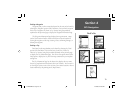
Section 4
GPS Navigation
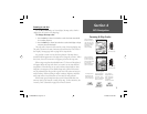
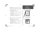
Map Navigator Page Options
Section 4
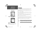
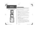
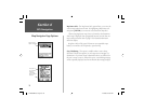
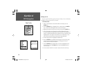
Measure Distance
Use the Panning Arrow to measure the
distance between two map items by
moving it to the fi rst item, pressing ENTER,
and then moving it to the second item.
The distance is displayed in the fi eld just
above the map.
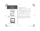
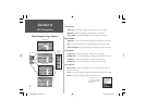
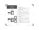
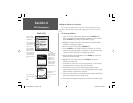
Routes List
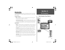
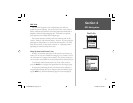
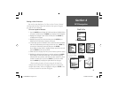
Measure Distance - The ‘Measure Distance’ option allows you to view
the distance and direction from your current location to another loca-
tion on the map or from one map location to another. In addition the
directional bearing from your current location is shown as well as the
coordinates for that other location.
To use the ‘Measure Distance’ feature:
1. With the Map page displayed, highlight and select ‘Measure Distance’
from the list of options.
2.
Press the ENTER key. A fi eld for distance will appear at the top of the map.
3. Move the panning arrow to the location you want to measure from and
press the ENTER key.
4. Move the panning arrow to the location you want to measure to and
the distance information will be displayed in the fi eld.
5. Press the CLEAR key or select ‘Stop Measuring’ to exit this feature.
Routes - You can create a route to a destination with Turn-By-Turn
directions and then save it for reuse. Refer to page 84 for details on
creating and saving a route.
To Select a Route from the Saved Routes List:
1. With the Map Navigator Page displayed, press the MENU key to “pop
up” the page Options Menu.
2. Use the ARROW key to highlight the “Routes” option and press
ENTER to display the Routes Page.
3. Highlight the desired saved route from the Saved Routes fi eld and press
ENTER to display that route on the Map Navigator Page.
Saved Routes
Current Route
NvTlkGSMManual copy.indd 75 12/2/2002, 8:43:03 AM