


74
Section 4
GPS Navigation
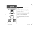
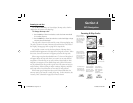
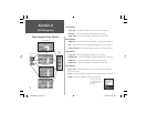
Map Navigator Page Options
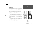
Line Options
Track Log - Controls the display of the ‘Track Log’ on the map.
Railroad - Controls the display of the Railways on the map.
Street Label - Controls the display of street names on the map.
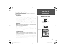
Point Options
Waypoint - Controls the method for display of waypoints on the map.
Exit - Controls the method for displaying highway exits on the map.
Points of Interest -
Controls the display of points of interest on the map.
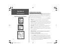
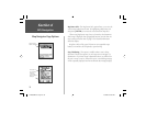
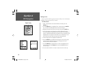
Point Options
Zoom
Options
Menu
Line Options
Text Options
Menu
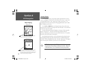
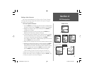
City Options
Large City - Controls the display of large cities on the map.
Medium City -
Controls the display of medium sized cities on the map.
Small City - Controls the display of small cities on the map.
Small Town - Controls the display of small towns on the map.
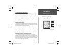
Area Options
River, Lake - Controls the display of river, lakes and other bodies of
water on the map.
Park -
Controls the display of parks and other public lands on the map.
Other - Controls the display of all other land forms.
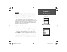
City Options
Area Options
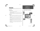
The Map Setup Options
can also be accessed from
the Settings Tab of the
Main Menu.
Section 4
NvTlkGSMManual copy.indd 74 12/2/2002, 8:43:02 AM