


73
Section 4
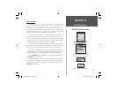
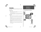
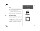
GPS Navigation
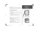
Map Navigator Page Options
Section 4
Detail
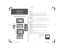
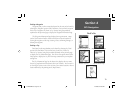
Options Menu
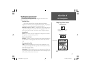
Orientation
Options Menu
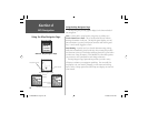
Map Options
AutoZoom Scale
Options Menu
Color Mode
Options Menu
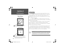
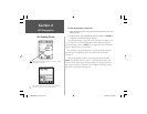
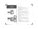
Map Page Settings
The Setup Map Options displays the Map Setting Pages. Map Settings
pages determine how the map is displayed, allowing you to custom tailor
the map display.
Common Settings
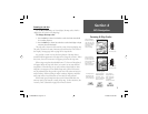
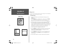
Text - Specifies the text size for a displayed map item. Selecting ‘Off’
will turn off the text display for that item.
AutoZoom (also Zoom) - Specifies the maximum map scale at which
a map item will be displayed. If ‘Auto’ is selected, the maximum map
scale will be determined by the ‘Detail’ setting to prevent map clutter.
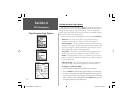
Map Options
Detail - Adjusts the amount of map information, such as roads, that is
displayed. ‘Most’ shows maximum detail and ‘Least’ shows minimum
detail. The higher level of detail, the slower the map redrawing time.
Orientation - Selecting ‘North Up’ will display the map with North
at the top. Selecting ‘Track Up’ will automatically rotate the map to
keep your current direction of travel at the top of the screen. A ‘North’
indicator is displayed on the map when in the ‘Track Up’ mode.
Color Mode - Allows the selection of either Land or Water Modes to
display map features on a light (Land) or dark (Water) background
AutoZoom - When ‘On’, this option will automatically adjust the map
scale to show both your current location and the next item to which
you are navigating.
NvTlkGSMManual copy.indd 73 12/2/2002, 8:43:01 AM