


26
Reference
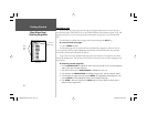
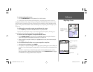
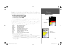
Map Page Options
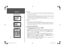
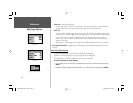
• Full Screen Map/Show Data — toggles between a full screen map or a map with sonar information
and/or data fi elds on the top half of the display. This allows for quick viewing of a full screen map.
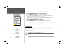
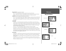
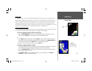
• Change Numbers — allows you to specify the type of data displayed in each data fi eld used on the
map display. This option is available from any of the main pages.
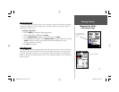
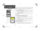
To change a data fi eld:
1. From the menu, use the ARROW KEYPAD to highlight the ‘Change Numbers’ option and press
ENTER.
2. Move the fi eld highlight to the data fi eld you want to change and press ENTER.
3. Move up or down on the list using the ARROW KEYPAD to highlight the data you want to display,
and press ENTER. To exit, press QUIT.
The following options are available for display in data fi elds on the main pages:
• BEARING – Compass direction from your position to destination
• COMPASS – Compass ribbon
• COURSE – Desired Track
• DEPTH – Depth below transducer
• DISTANCE TO DESTINATION – Distance to fi nal waypoint
• DISTANCE TO NEXT – Distance to next waypoint
• ELEVATION – Altitude above/below MSL (Mean Sea Level)
• ETA AT DESTINATION – Estimated Time of Arrival to fi nal waypoint
• ETA AT NEXT – Estimated Time of Arrival to next waypoint
• GPS ACCURACY – Shows estimated GPS accuracy
• HIGHWAY – Smaller version of the Highway Page
• MAXIMUM SPEED – Fastest speed the unit has traveled
• MOVE AVERAGE SPEED – Average moving speed
• MOVE TRIP TIME – Time unit has been moving for a trip
• OFF COURSE – Distance from desired track
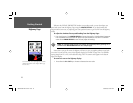
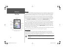
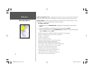
Full Screen Map (with BlueChart data)
188188C238 Manual Part 1.indd 26 6/30/2003, 3:34:39 PM