


114
Appendix I
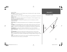
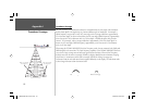
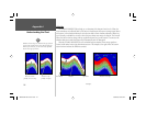
Understanding the Chart
Whiteline
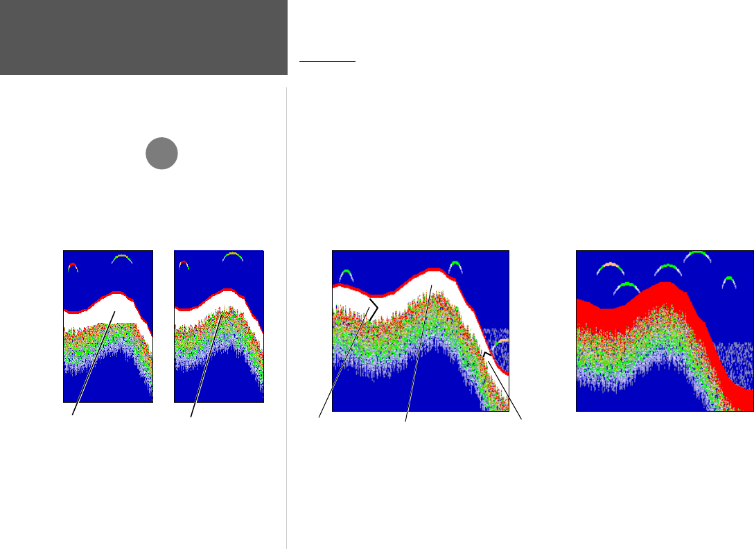
The GPSMAP 188/188C/238 can help you to determine if the bottom is hard or soft. When the
sonar soundwaves are refl ected back by the bottom, a hard bottom will return a stronger signal than a
soft bottom. A thin whiteline indicates a softer bottom while a thick whiteline indicates a harder bot-
tom. Normally, a red/dark line is used to show the point where water meets the bottom. This line will
follow the bottom contour, along with any signifi cant objects lying on the bottom. The unit uses the
whiteline function to make this bottom layer information easier to distinguish.
With the GPSMAP 188/188C/238, active whiteline helps accentuate where strong signals are
located, which make bottom type determination easier. The example to the right shows the bottom
return with and without the whiteline activated.
)
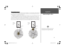
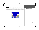
Whiteline can also help you to determine the type of bottom
structure that is displayed on the chart. By determining the
hardness of the structure, you can make a better informed
decision on the type of structure.
Structure is hard—
probably a rock or stump
Structure is soft—
probably a mud pile
Example 4.
Whiteline Turned OffHard Bottom
Whiteline
Soft Bottom
188188C238 Manual Part 2.indd 114 6/30/2003, 3:32:59 PM