


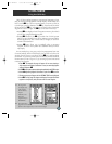
1
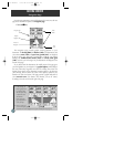
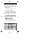
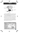
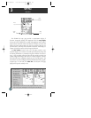
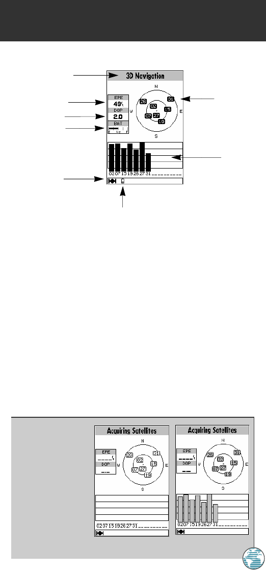
The GPSMAP 175 status page provides a visual reference of various
receiver functions, including current satellite coverage, receiver operating
mode, battery strength and current receiver accuracy. The status information
will give you an idea of what the receiver is doing at any given moment.
The sky view and signal strength bars give you an indication of what
satellites are visible to the receiver and whether or not they are being tracked.
The signal strength is shown on a bar graph for each satellite, with the satellite
number below. When a satellite is visible but not being tracked, the strength
bar will not be shown and the sky view indicator will not be highlighted.
The sky view shows a bird’s-eye view of the position of each satellite relative
to the receiver’s last known position. The outer circle represents the horizon
(track up), the inner circle is 45º above the horizon, and the center point is a
position directly overhead. Use the sky view to determine if there are
obstructions shading your reception of GPS signals.
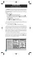
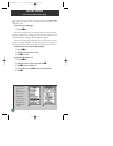
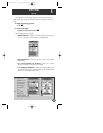
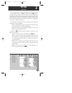
A. Whenever the
GPSMAP 175 is
searching for
satellites, no signal
strength bars will
appear.
B. Once the receiver has
found the satellite(s)
indicated, a hollow
signal strength bar
will appear. After
satellite data has been collected, the signal strength bars will become solid.
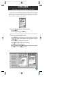
23
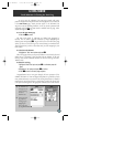
Status Field
Horizontal Accuracy
Satellite
Sky View
Signal Strength
Indicators
Status Bar
Battery Icon
Dilution of Precision
Battery Gauge
1
STATUS PAGE
Overview
175 Manual 7/31/98 3:56 PM Page 23