


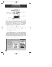
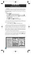
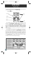
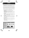
A. In this example, our
boat is right of course
by 1/16th of a mile.
(The base of the map
is equal to the scale
selected at the
bottom right of the
page.) To get back on
course, steer left.
B. Here, our boat is off
course to the left. To get back on course, steer right. A digital readout of your
crosstrack error can be displayed in any of the six data fields (see page 35).
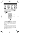
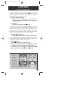
GETTING STARTED
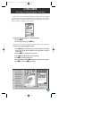
Navigation Page
Now that we’re navigating to an actual destination, let’s move on to the next
page of the GPSMAP 175 system, the navigation page:
1. Press the J key.
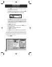
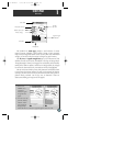
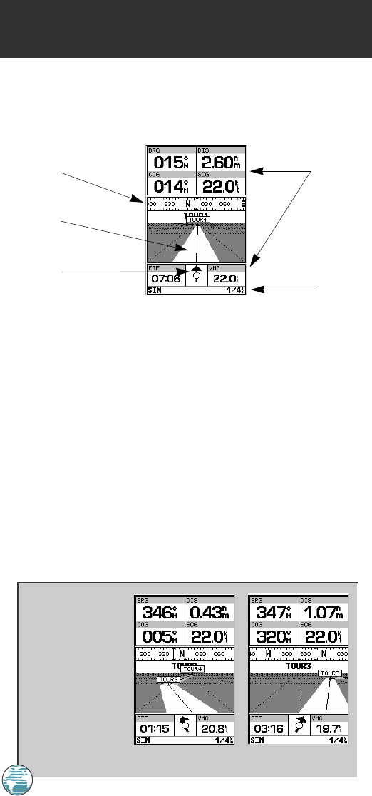
The navigation page provides graphic steering guidance to your
destination. The bearing (BRG) and distance (DIS) to the destination, with
your current course (COG) and speed over ground (SOG), are displayed
at the top of the page, along with a compass tape to indicate your cardinal
heading. The estimated time enroute (ETE) and velocity made good
(VMG, or the rate you are closing in on your destination) are displayed at the
bottom of the page.
As you head toward the destination, the middle section of the page gives
you visual guidance to your waypoint on a graphic highway, which displays
the route and nearby waypoints on screen. The moving arrow below the
highway always points to the destination waypoint relative to the direction
you’re moving. The line down the center of the highway represents your
desired track, while the bottom of the page provides a graphic indication of
your crosstrack error (the distance and direction you are off course)
according to the scale at the bottom right of the page.
18
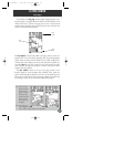
Data
Fields
CDI
Scale
Graphic
Highway
Compass Tape
Pointer to
Waypoint
175 Manual 7/31/98 3:56 PM Page 18