


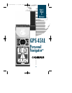
Getting Started with your GPS
Welcome to the exciting world of GARMINGPS! The
GPS 45XL represents GARMIN’s continuing commitment to
provide marine users with quality navigation information in
a versatile, user-friendly design they will enjoy for years to
come. To get the most out of your GPS receiver, be sure to
read through the initialization and Getting-Started sections
of this manual, and refer to the reference section for com-
plete details on the GPS 45XL’s advanced features.
Initializing Your GPS for First-Time Use
The GPS 45XL calculates your position and movement
by tracking signals sent from GPS satellites. Each of the 24
GPS satellites circle the earth twice a day in a very precise
orbit, and transmit information back to earth. In order to
determine a position fix, your GPS 45XL needs to continu-
ously “see” at least three satellites.
Because a GPS receiver can only see satellites above the
horizon, it needs to know what satellites to look for at any
given time. By using an almanac (a timetable of satellite
numbers and their orbits) stored in the receiver’s memory,
the GPS 45XL can determine the distance and position of
any GPS satellite.
To use this almanac data, your GPS receiver needs to
know where you are, or be given the opportunity to “find
itself”. Once you initialize the unit to this position, the GPS
45XL will usually compute a fix within a few minutes.
Remember, this process is only necessary under the
following conditions:
• First time use from the factory.
• The receiver has been moved over 500 miles from
the last calculated position with power off.
• The receiver’s memory has been cleared and all
stored data has been lost.
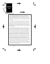
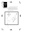
Getting Started
Initialization
&
Lanyard
Attachment
5
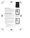
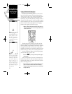
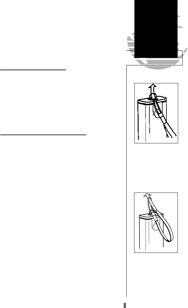
Next, take the solid end
of the lanyard , insert it
through the slot at the
other end, and tighten.
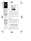
Lanyard Attachment
To attach the GPS 45XL’s
lanyard, thread the strap
t h rough the D-ring on
the battery compartment
cover.
GPS 45XL Manual C 8/4/98 3:05 PM Page 5