


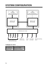

1. OPERATIONAL OVERVIEW
1-4
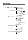
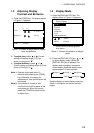
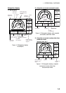
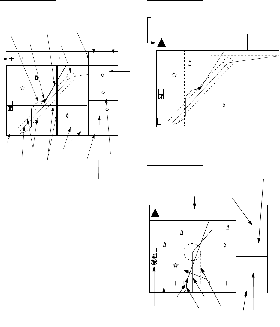
Plotter 1 display
44
D3D 100m
SAFE
34 23.456´ N 135 45.678´ E
BRG
32
BRG TO +
11.5
RNG TO +
nm
123
COG
[01]
30
40
20
50
H
2.00 nm
Cursor position data,
when cursor is on
Own ship's
track
Own ship
mark
Course
bar
Bearing from own ship
to destination waypoint
GPS receiving
condition
Alarm
range
Range from own ship
to destination waypoint,
or bearing from own
ship to cursor
Course
Grid
Cursor
Speed, or range
from own ship
to cursor
Course
width
Course
Horizontal
range
WGS84
Distance for
RAIM reliability
RAIM
reliability*
*: For RAIM function, refer to page 8-1.
Figure 1-5 Plotter 1 display
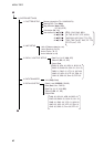
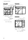
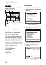
Plotter 2 display
[01]
30
40
20
50
H
2 nm
Ship's position appears when cursor is off.
D3D 100m
SAFE
34° 23.456´ N 135° 45.678´ E
WGS84
Figure 1-6 Plotter 2 display
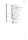
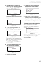
Highway display
234˚
34˚ 23.456´ N 135˚ 45.678´ E
BRG
345˚
RNG
123
12.3
SOG
nm
kt
COG
[01]
H
[02]
1
1
nm
Position
Bearing from own ship
to destination waypoint
Course
Speed
Range from own ship
to destination waypoint
Course
width
Course
Own
ship's
track
Own
ship
mark
North
mark
Cross track
error scale
2
2
D3D 100m
SAFE
Figure 1-7 Highway display