1. OPERATIONAL OVERVIEW
1-16
1.8 Data Boxes
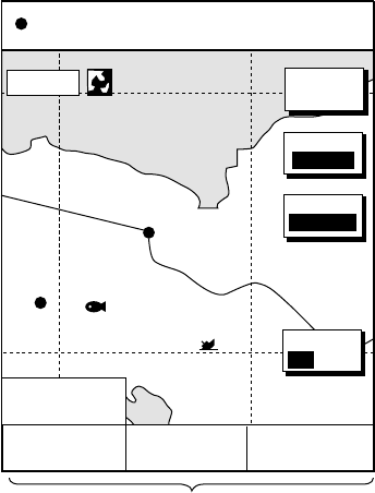
Data boxes, providing navigation data, may be shown on any full-screen display.
Up to six data boxes (two in case of large characters) may be shown, and the
default data boxes are position (in latitude and longitude), course over ground,
speed over ground and trip log. The user may choose which data to display,
where to locate it, and show or hide it as desired. In addition, data boxes may be
set independently for each display mode (plotter, radar, sounder). For how to
select data for the data boxes, see the paragraph “5.4 Data Boxes Setup”.
Data boxes
BRIDGE
FISH
002WP
34° 22. 3456'N 359.9°M TRIP NU
080° 22. 3456'E
19.9 kt 99.9 nm
MODE
NTH UP
NAV
POS
MARK
ENTRY
D.BOX
ON /OFF
16.0nm
POSITION
47
°
58.535'N
122
°
36.496'W
COG
323.6
°
M
SOG
20.0 kt
TRIP LOG
4.58
nm
Plotter display, showing data boxes
1.8.1 Showing, hiding data boxes with soft key
Plotter: D. BOX ON/OFF
Radar: ZOOM & D. BOX
→ D. BOX ON/OFF (EBL/VRM data box, cursor data
box also shown/hidden)
Sounder: AUTO/D. BOX
→D. BOX ON/OFF
1.8.2 Rearranging data boxes
You may select the location for data boxes as follows:
1. Using the cursor pad, place the cursor inside the data box you wish to move.
As the cursor enters the box it changes to a hand. Push the [ENTER] knob,
and the hand changes to a fist, meaning the box is correctly selected.
2. Use the cursor pad to move the data box to the location desired, then push
the [ENTER] knob.
1.8.3 Temporarily erasing a data box
You may temporarily erase a data box. Use the cursor pad to place the cursor
inside the data box you wish to erase, then press the [CLEAR] key. To redisplay
the box, press the D.BOX soft key twice to display it.


