


-1.29-
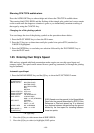
Manual speed entry is done at menu item 6 SHIP'S SPEED on the FUNCTIONS 2 menu
which is accessed by pressing the RADAR MENU key.
CAUTION
Do not use the Echo Average function
under heavy pitching and rolling loss of
target detection can result.
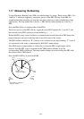
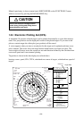
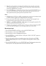
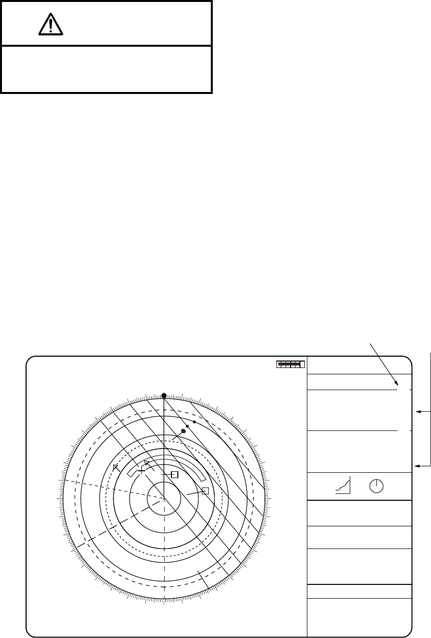
1.24 Electronic Plotting Aid (EPA)
A maximum 10 operator-selected targets can be plotted electronically to assess their motion
trend. Five past positions can be displayed for each of the plotted targets. If you enter a 6th
plot on a certain target, the oldest plot (past position) will be erased.
A vector appears when you enter a second plot for the target and is updated each time a new
plot is entered. The vector shows the target motion trend based on its latest two plots. The
vector origin will move across the screen at a rate and direction defined by the calculated true
course and speed until a next manual plotting.
Target data is shown in the data display area which shows:
bearing, course, speed, CPA, TCPA, calculated true course of targets, calculated true speed of
targets
A/C AUTO
NOISE
REJ
OFFCENTER
Long-1
EBL
287.2° R
240.0° R
12/
2NM
+ 4.2NM
320.2° R
HEAD UP RM
PULSE 1 M1
EAV 1
ES1
Disp 1
ANT 1 MAIN
LOG F 10.0 KT
SB -1.0 KT
TRUE TRAIL
3MIN 1:25
TGT ALARM 1
TGT ALARM 2
VRM
10.75NM
7.00NM
000
010
020
030
040
050
060
070
080
090
100
110
120
130
140
150
160
170
180
190
200
210
220
230
240
250
260
270
280
290
300
310
320
330
340
350
EPA time
X-Band
IR3
HDG 155.0° T
SPD 12.0KT BT LOG
EPA
REL VECTOR 6MIN 3:20
12MAR 1998
13:28
... SIGNAL MISSING ...
GYRO LOG EPFS TRIGGER
VIDEO AZIMUTH HEAD LINE
... ARPA ALARM ...
COLLISION GUARD LOST
TARGET FULL (AUTO + MAN)
140.9
°
INDEX LINE
9.5
0
20
40
60
80
100
-30 20 10
N
S
WE
AUTO TUNE
1
2
RNG 3.5NM
BRG 25.5°R
01 CSE 264.0°T BT TRU
SPD 12.3K BT TRU
CPA 2.9NM
TCPA6MIN
BCR 2.9MIN
BCT 6MIN
RNG 4.7NM
BRG 78.5°R
CSE 264.0°T BT TRU
SPD 12.3K BT TRU
02 CPA 0NM
TCPA23MIN
BCR 0MIN
BCT 23MIN
DEPTH 21.1m
CURRENT1.2KT
105.7°R
11.3KT
285.6
WPT 2 150.8NM
155.0°T
01 → + 11.7NM
162.5°T
OWN SHIP GPS
34°40.849N
125°18.115E
+ CURSOR POSN
34°39.039N
135°18.303E
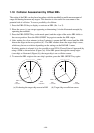
Target Data
3:20
1:25