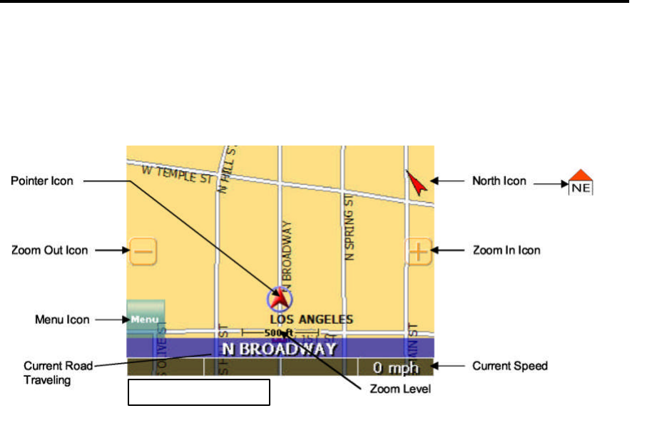
Map Page
The Map Page displays your current position, zoom in/out icons and zoom level in miles, the street
you’re traveling on, your current speed, and Menu icon. The pointer represents your location and
direction on the map.
The pointer icon also indicates the signal strength of the satellite signals: Silver = no signal; Red =
poor signal; Yellow = weak signal and Green = good signal.
Zoom In/Out
The zoom level is displayed in the lower center of the map page. To change the zoom level, tap the
zoom icons on the screen or the (+) or (-) buttons on the GPS unit. Note: Street details are not
shown higher than zoom level of 2000 ft.
Track Up (Heading) or North Up
In the upper right hand corner is the North indicator icon. This indicator will always point to the
north. While traveling, the direction of travel (Pointer Icon) is always pointing up and the map
rotates around the Pointer Icon.
When the map is switched to North Up from the defaulted Track Up, North is always at the top of
the screen while the direction of travel (N,S,E,W etc.)is displayed under the red arrow. See Figure
above for an example for a NE direction of travel.
There are three ways to change the display:
North IconPointer Icon
Zoom Out Icon
Menu Icon
Zoom In Icon


