


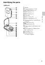
7
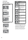
Read this first
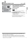
Step 3
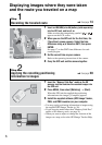
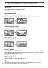
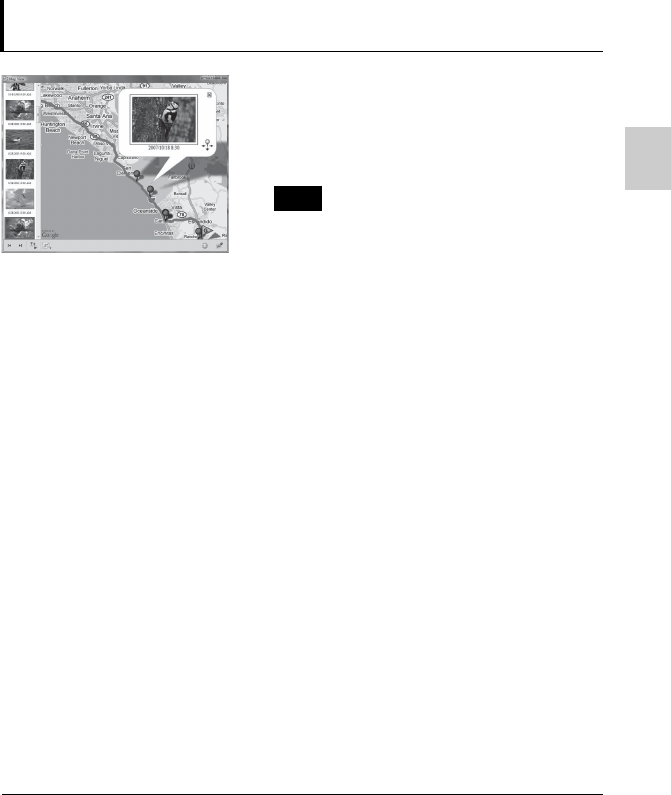
Displaying the images on a map
, See page 30.
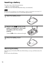
1 Insert the “Memory Stick Duo” media or the SD
memory card that contains the images with
positioning information into the camera, and connect
the camera to the computer.
PMB starts automatically.
2 Import the images.
If GPS Image Tracker is opened, close GPS Image
Tracker after importing the images.
3 Start PMB Launcher, and click “Display Images on
the Map with Map View.”
The images and the location where you shot them will
be displayed on the map.
• To use the world map, the computer needs to be
connected to the Internet. The online map and the aerial
photomap are powered by Google Maps.
• You can use network services and Google Earth using the supplied PMB. See the
PMB support page for more information.
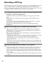
• You can use the GPS unit as a GPS logger. Using GPS Image Tracker, import the
GPS log that was recorded by the GPS unit while you were carrying the GPS unit
that was turned on, and connected to a computer. Then, the route you traveled will be
displayed on a map, using PMB.
Note