


31
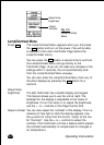
Operating Instructions
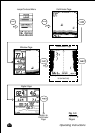
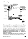
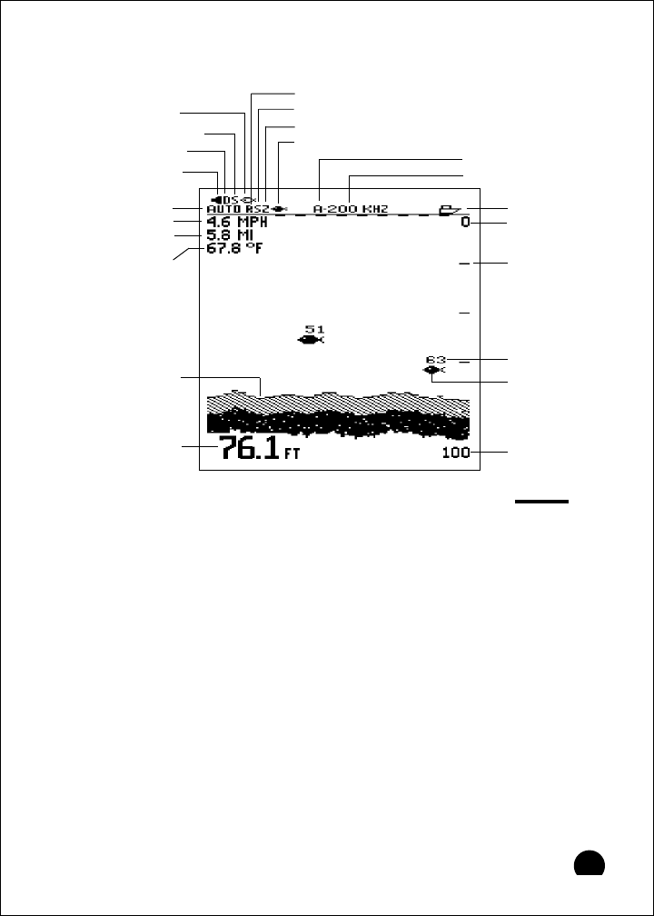
FishFinder Page
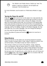
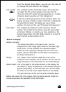
Figure 3-4 shows a typical FishFinder display. (The FishFinder Page is
also called the “chart” or “bottom graph” display.) As time passes, this
display scrolls from right to left. The scrolling image becomes a record of
the echoes and the bottom seen by the FishFinder as your boat moves.
The images at the right side of the display show the most recent echoes.
Some of these echoes indicate fish, and others show the bottom. As new
echoes are received, the FishFinder “draws” a graph of the bottom. The
bottom graph helps you to tell whether the bottom is rising or falling. It
also allows you to identify the shape or “structure” of the bottom. This can
indicate a reef or shipwreck.
Notice that the scrolling speed of the display does not necessarily match
the speed of the boat. The scrolling speed of the display is called the
Fig. 3-4
FishFinder
Page
Deep alarm set
Shallow alarm set
Speed
Log/distance
Water
temperature
Transducer frequency
Auto
features on
Buzzer symbol
Fish alarm set
Bottom
indication
Boat symbol
Depth markers
Fish symbol
Fish depth
Bottom depth
Fish symbol on
Water surface
Range
Auto range on
Auto sensitivity on
Auto zoom on
Auto frequency on