


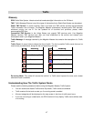
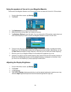
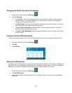
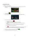
Changing the Route Calculation Parameters
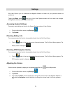
enu screen, tap Settings. 1. From the Main M
2. Tap Trip Planning.
• Tap Vehicle to select the vehicle type used in route calculation. (Vehicle types are used in
eways and emergency
when routing. You can also
raffic messages are taken into account
ss Traffic events on the map and in the list
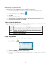
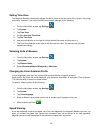
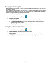
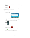
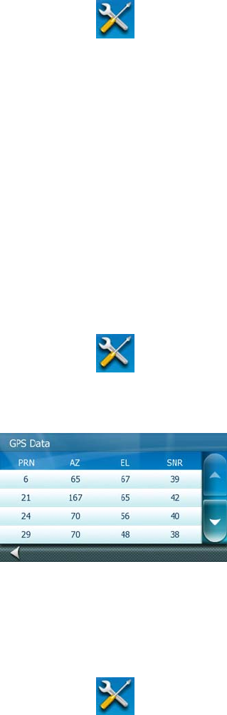
Viewing Technical GPS Information
to compute the GPS position.
1. From the Main Menu screen, tap Settings
route calculation. For example pedestrians are not allowed on fre
vehicles have less traffic restrictions.)
• Tap Road Types to define which road types to use and to avoid
define whether to cross borders during your journey.
• Tap Use Traffic Information to decide whether T
when calculating or recalculating a route.
• Tap Show Traffic Messages to display or suppre
of Traffic events.
This screen provides technical information about the satellites being used
.
2. Tap GPS.
3. Tap GPS Data.
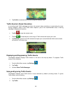
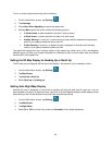
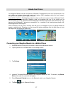
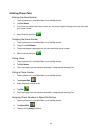
Setting the GPS Position
nformation quickly due to traveling over
ff. Setting the GPS position will allow the Magellan
satellites are available and calculate the position more quickly.
It is useful to set a GPS position if you are not receiving satellite i
500 mi/800 km with the Magellan Maestro turned o
Maestro to compute which
1. From the Main Menu screen, tap Settings.
2. Tap Set GPS Position.
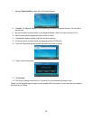
3. Use the same search methods (address, POI, Coordinate, Previous, etc.) as you were selecting a
destination.
55