


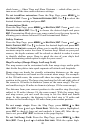
80
check boxes — Show Time and Show Distance — which allow you to
turn on or off the time and/or distance settings.
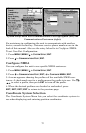
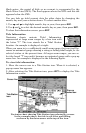
To set trackline extension: From the Map Page, press
MENU|↓ to
MAP DATA|ENT. Press ↓ to TRACKLINE EXTENSION|ENT. Use ↑ ↓ to select the
desired distance setting and press
ENT.
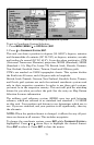
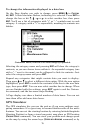
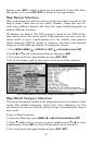
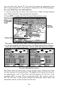
Presentation Mode
From the Map Page, press
MENU|↓ to MAP DATA|ENT. Press ↓ and → to
PRESENTATION MODE|ENT. Use ↑ ↓ to choose the desired depth and press
ENT. Presentation Mode gives you some control over the map layout by
allowing you to choose between US and International Modes.
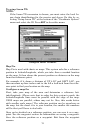
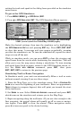
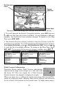
Safety Contour
From the Map Page, press
MENU|↓ to MAP DATA|ENT. Press ↓ and → to
SAFETY CONTOUR|ENT. Use ↑ ↓ to choose the desired depth and press ENT.
The
SAFETY CONTOUR command allows you to modify depth contours on a
navionics map for water less than 10 meters deep. Based on your pref-
erences, the depth contours will be colored or shaded to make it easier
to identify shallow areas. Keep in mind the size of your ship's keel
when determining which option is right for your vessel.
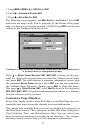
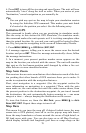
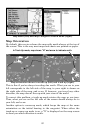
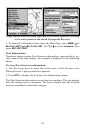
Map Overlays (Range Rings; Lat/Long Grid)
The map screen can be customized with four range rings and/or grids
that divide the plotter into equal segments of latitude and longitude.
Range rings are handy for visually estimating distances on the map.
The ring diameters are based on the current zoom range. For example:
at the 100-mile zoom, the screen will show two rings with your current
position in the center. The large ring touching the left and right sides of
the screen is 100 miles in diameter (same as the zoom range). The sec-
ond smaller ring is 50 miles in diameter (always 1/2 the zoom range).
The distance from your current position to the smaller ring (the ring's
radius) is 25 miles (always 1/4 the zoom range). With the arrow keys
and map cursor, you can scroll the map to see the third and fourth
rings. In this example, the distance to the third ring is 75 miles and
distance to the fourth ring is 100 miles from your current position.
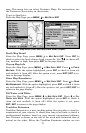
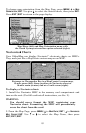
To set range rings: From the Map Page, press
MENU|↓ to MAP
DATA|ENT. Press ↓ and → to RANGE RINGS. With the option highlighted,
press
ENT to check it (turn on) and uncheck it (turn off.) After the op-
tion is set, press
EXIT|EXIT to return to the page display.
To set Lat/Long Grid: From the Map Page, press
MENU|↓ to MAP
DATA|ENT. Press ↓ and → to LAT/LON GRID LINES. With the option high-