


79
map. This menu lets you select Navionics Maps. For instructions, see
the Navionics Charts entry in this section.
To get to Map Data:
From the Map Page, press
MENU|↓ to MAP DATA|ENT.
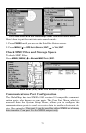
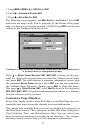
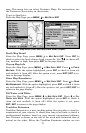
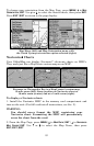
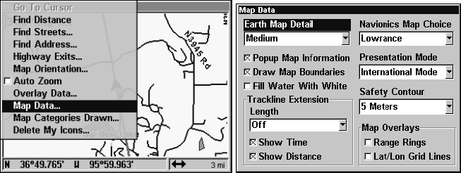
Map Menu (left) and Map Data Menu (right).
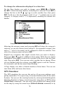
Earth Map Detail
From the Map Page, press
MENU|↓ to MAP DATA|ENT. Press ENT to
check to select the level of map detail you prefer. Use ↑ ↓ to choose off,
low, medium or high, then press
EXIT to the page display.
Pop-up Map Info
From the Map Page, press
MENU|↓ to MAP DATA|ENT. Press ↓ to POPUP
MAP INFO. With the option highlighted, press ENT to check it (turn on)
and uncheck it (turn off.) After the option is set, press
EXIT|EXIT to re-
turn to the page display.
Draw Map Boundaries
From the Map Page, press
MENU|↓ to MAP DATA|ENT. Press ↓ to DRAW
MAP BOUNDARIES. With the option highlighted, press ENT to check it (turn
on) and uncheck it (turn off.) After the option is set, press
EXIT|EXIT to
return to the page display.
Fill Water with White
From the Map Page, press
MENU|↓ to MAP DATA|ENT. Press ↓ to FILL
WATER WITH WHITE. With the option highlighted, press ENT to check it
(turn on) and uncheck it (turn off.) After the option is set, press
EXIT|EXIT to return to the page display.
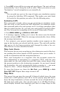
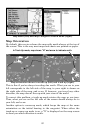
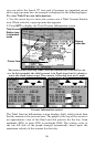
Trackline Extension
Trackline Extension is a new tracking option that provides a visual in-
terpretation of your velocity. It charts how long it will take to travel a
predetermined distance based on your current navigational informa-
tion. Distance is shown on one side of the track with estimated time of
arrival on the other. Below the Trackline Extension window are two