14
Grid Lines
The GlobalNav 200 can place grid lines on the
plotter to help you see your position, or the posi-
tion of waypoints and icons.
To do this, highlight the “Grid” label on the “Plotter
Options” menu, then press the right arrow key to
turn them on. Press the EXIT key to exit this menu.
A plotter screen similar to the one at right appears.
The grid lines appear as vertical and horizontal
dashed lines.
Plotter Update
The plotter places a dot on your trail as you move. It determines when to
place a dot depending on either time or distance. By default, it places a
dot every three seconds.
To change the update method from time to distance, highlight the “Update
By” label, then press the right arrow key. This moves the label from “TIME”
to “DIST”.
If you want to change the update time or distance, simply highlight either
the “UPDT RATE” to change the update time or the “UPDT DIST” to change
the update distance, then press the left or right arrow keys until the de-
sired setting appears. Press the EXIT key to erase the plotter menu.
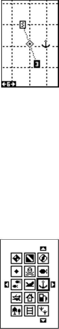
ICONS
The GlobalNav 200 has fifteen symbols or “icons” available. These icons
can be placed anywhere on the plotter screens. These can be used to
mark fishing or hunting spots, boat ramps, rest stops, or whatever. You
can place an icon at your present position, or at
the cursor location.
Place Icon - Present Position
To place an icon at your present position, simply
press the ENT key. The screen shown at right
appears. Use the arrow keys to move the black
box to the desired icon. Now press the ENT key.
The plotter screen appears with the icon you se-
lected placed at your position when you first
pressed the ENT key, not your present position.
GRID LINES


