


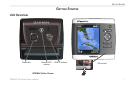
GPSMAP
®
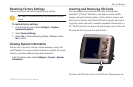
400 Series Owner’s Manual 9
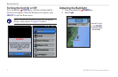
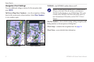
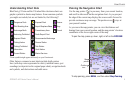
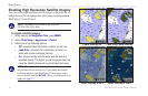
uSInG chartS
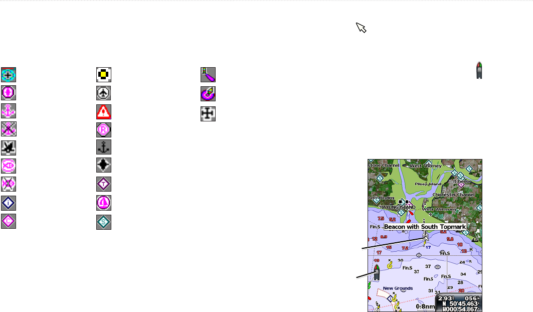
Understanding Chart Data
BlueChart g2 Vision and the US inland lake electronic charts use
graphic symbols to denote map features. Some common symbols
you might see include, but are not limited to, the following*:
Dangerous Rock Exposed Rock Beacon
Pilot Boarding Area Airport/Seaplane Base Buoy
Anchorage Berth Precautionary Area Church
Anchoring Prohibited Radio Report Point
Exposed Wreck Recommended Anchorage
Fishing Harbor Rescue Station
Fishing Prohibited Tide Station
Information Yacht Harbor
Current Station Marine Services
*Some symbols might appear differently on your Garmin unit.
Other features common to most charts include depth contour
lines (with deep water represented in white), intertidal zones, spot
soundings (as depicted on the original paper chart), navigational aids
and symbols, and obstructions and cable areas.
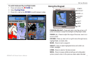
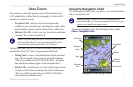
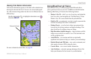
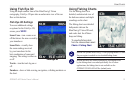
Panning the Navigation Chart
Use the map pointer ( ) to pan away from your current location,
and scroll to other areas on the navigation chart. As you pan past
the edge of the current map display, the screen scrolls forward to
provide continuous map coverage. The position icon ( ) stays at
your present location.
As you move the map pointer, you can view the distance and
bearing from your current location, and the map pointer’s location
coordinates in the lower-right corner of the map.
To pan the map, press up, down, right, or left on the ROCKER.
Map
pointer
Position
icon
To stop panning, press MENU, and then select Stop Panning.