


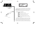

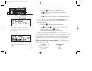
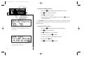

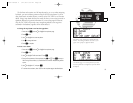

When the ‘auto’ CDI setting is selected, the
GNC 250XL will automatically change the CDI
scale when you are within 30 nm of a departure
or arrival airport.
SECTION
6
UNIT SETTINGS
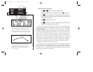
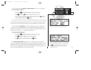
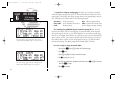
Map Page Setup
CDI Settings
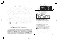
The ‘auto mag’ setting will automatically calculate
the magnetic variation based upon your current
position.
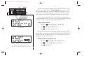
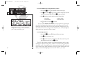
To enable/disable airspace boundaries on the map:
1. Press and hold
M
, then rotate
O
to select the ‘MAP Setup’ page.
2. Press
C
twice and rotate
O
to highlight ‘class B/cta’, ‘class C/tma’, ‘moa’,
‘restricted’ or ‘other sua’.
3. Rotate
K
to select the maximum map scale for the designated airspace type, or select
‘off’ to never display.
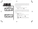
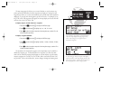
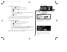
The next page under the settings submenu is the CDI settings page, which
allows you to define the scale of the GNC 250XL’s course deviation indicator.
To change the CDI scale:
1. Press and hold
M
, and rotate
O
to select the ‘CDI Settings’ page.
2. Press
C
twice and rotate
K
to select ‘Auto’, ‘
+
-
5.0 nm’, ‘
+
-
1.0 nm’ or ‘
+
-
0.3 nm’.
3. Rotate
O
to highlight ‘ok?’ and press
E
to approve.
(Note: the selected CDI scale will not take effect until approved.)
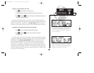
The scale values represent full scale deflection of the CDI to either side. The
default setting is
+
-
5.0 nm. The ‘Auto’ setting will start the CDI scale at 5 nm (en
route), and gradually ramp down the scale to the 1 nm range once you are within 30
nm of a departure or arrival airport (terminal area). For auto CDI scaling to occur,
you must have an active direct-to or route with an airport as your final destination
waypoint, or be within 30 nm of a departure airport. Note that the GNC 250XL uses
Receiver Autonomous Integrity Monitoring (RAIM) to cross-check its position.
The RAIM protection limits listed below follow the selected CDI scale, changing auto-
matically with the ‘Auto’ setting:
CDI Scale RAIM Protection
+/-5.0 nm or Auto (en route) 2.0 nm
+/- 1.0 nm or Auto (terminal) 1.0 nm
+/- 0.3 nm 0.3 nm
78
250xl manual 2 7/17/98 1:33 PM Page 78