


05-06
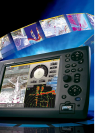
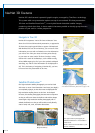
NavNet 3D Features
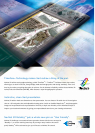
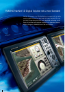
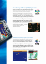
NavNet 3D is built around a powerful graphic engine, managed by TimeZero
TM
technology.
This system adds new presentation options on top of conventional 2D chart presentation:
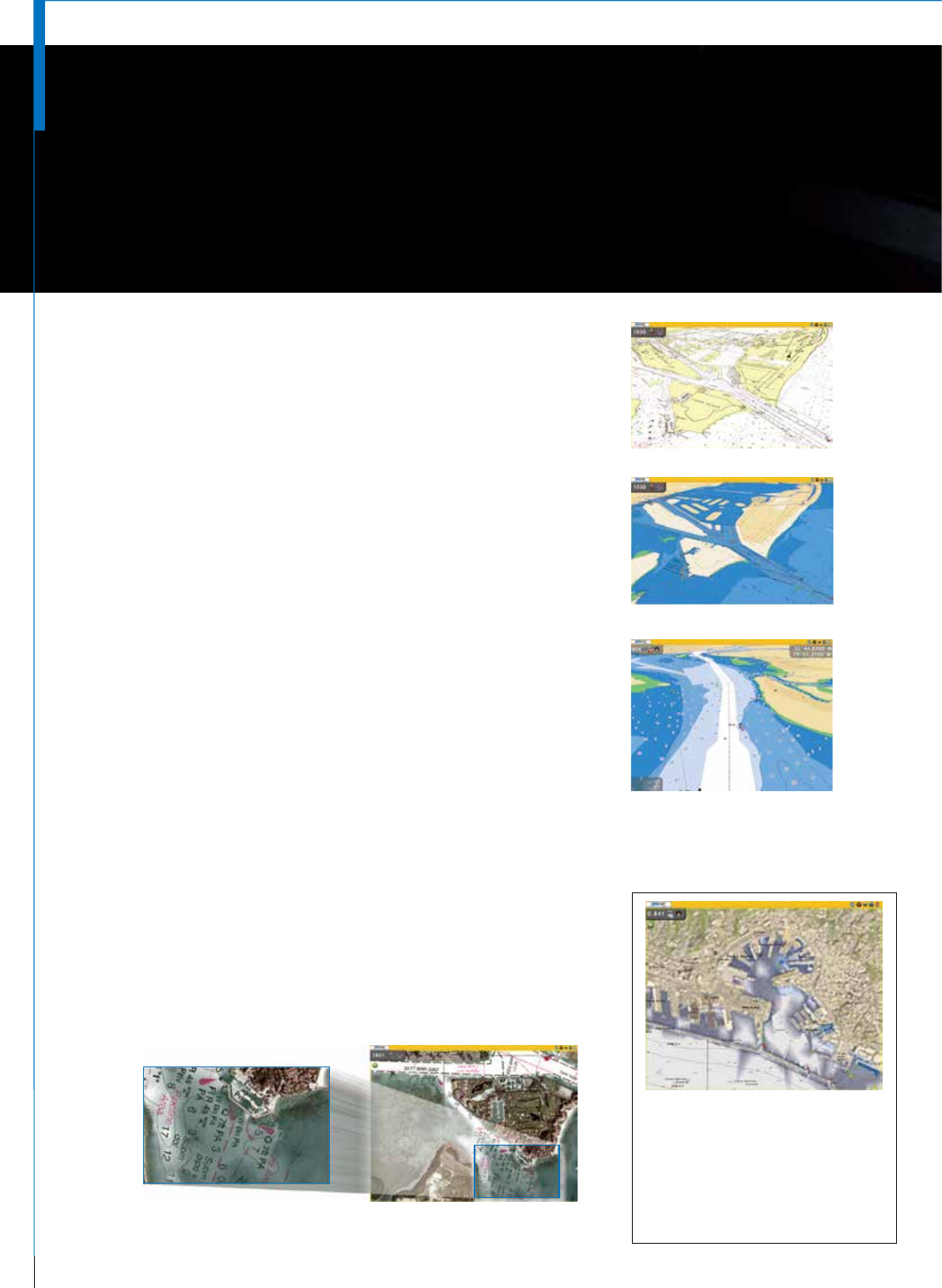
3D chart and Satellite PhotoFusion
TM
, a new hybrid blend of detailed satellite imagery
containing critical chart data. In these modes it becomes possible to visually grasp the exact
position of your craft in a wider perspective.
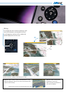
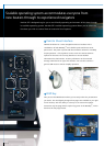
NavNet 3D incorporates “native 3D chart architecture” that
allows for a full time 3-dimensional presentation, as opposed to
2D charts that require special effects to appear 3-dimensional.
With NavNet 3D’s true 3D environment, you can see all of the
information you want with no limitations on what information
you wish to view. Plan your routes and enter points directly
on your raster or vector native 3D charts. Overlay a variety
of data with a touch of the RotoKey
TM
, such as Radar overlay,
AIS and ARPA targets plus all of your chart symbols and depth
soundings; any and all of the information can be displayed at
will. This is the beauty of navigating in NavNet 3D, you have
full control over the presentation at all times.
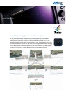
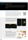
Navigate in True 3D
3D Raster
3D Vector
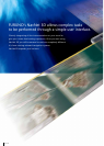
Our high-resolution satellite photography can now be fused
with raster or vector chart information. Land areas (zero depth)
are completely opaque, so that these areas are displayed with
high-resolution satellite photos on the chart. As the depth
increases, the satellite photography becomes more transparent
so that you will know where the shallows end and the deeper
water begins. High-resolution satellite photography aids in
seabed classication so that you will be able to easily identify
areas of sand, rock, coral, and other obstructions.
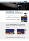
Satellite PhotoFusion
TM
Satellite & Raster/PhotoFusion
TM
(High-resolution)
C-Map by Jeppesen 3D Vector (option)*
* For detailed information, please refer to page 17-18.
The high-resolution photography for
Satellite PhotoFusion
TM
is not available in
certain areas.
Please consult with the distributor in your
area for availability.
Satellite & Vecter/PhotoFusion
TM
(Low-resolution)